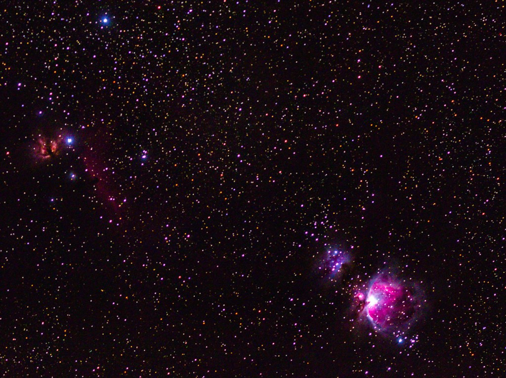
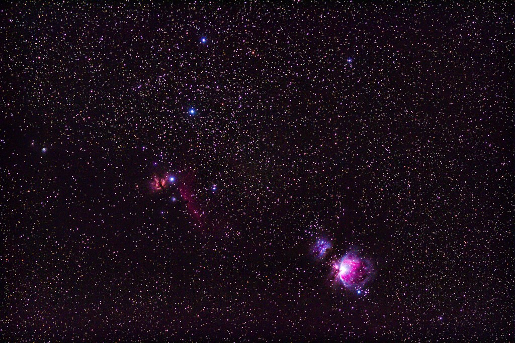
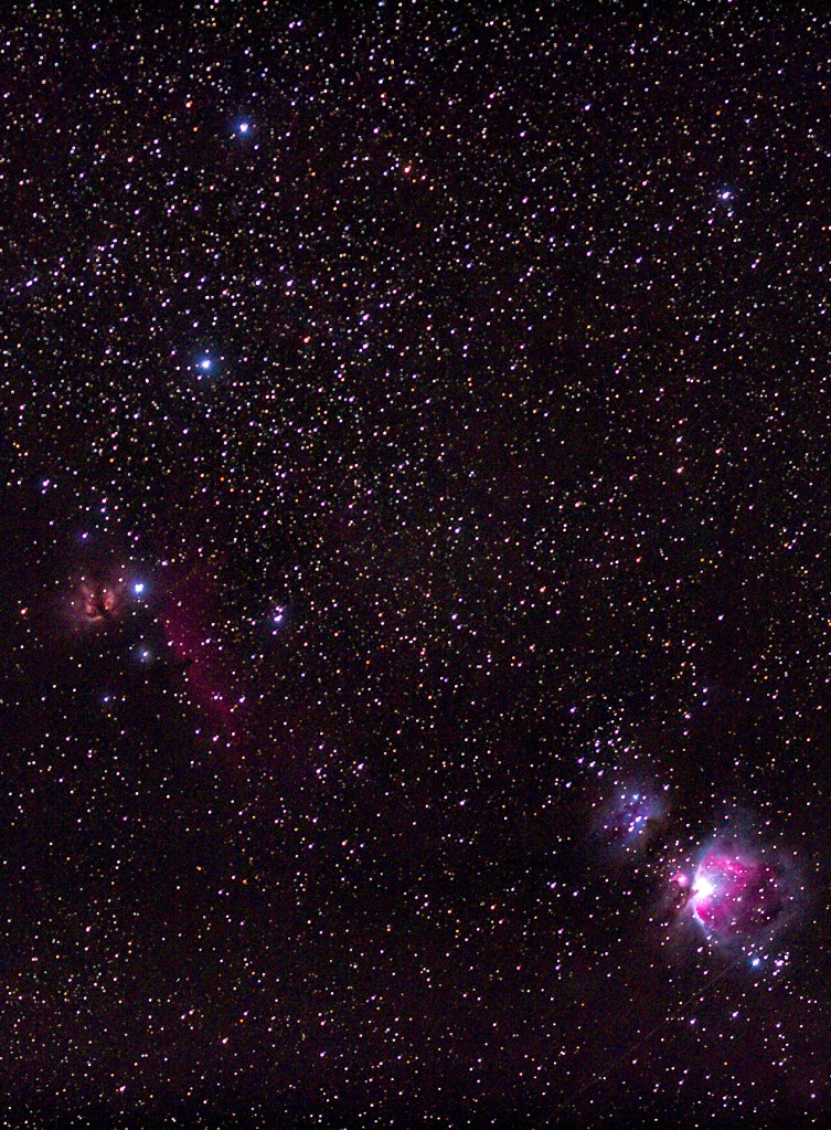
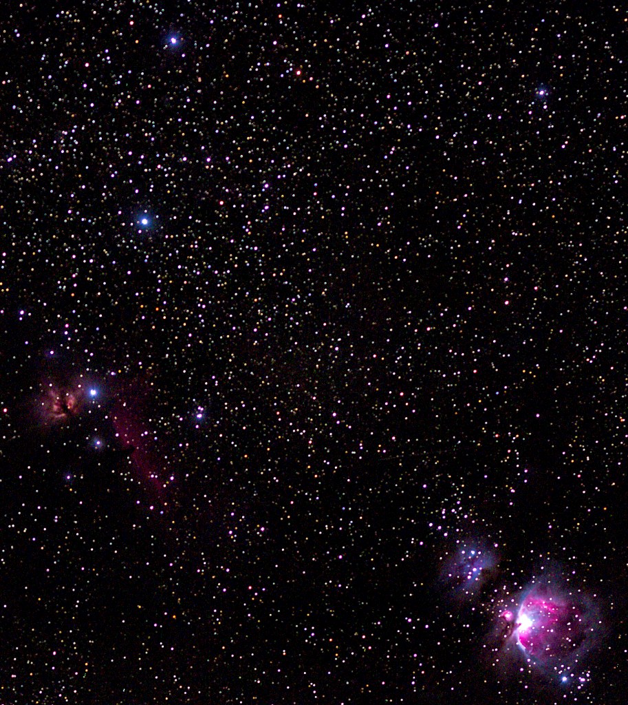
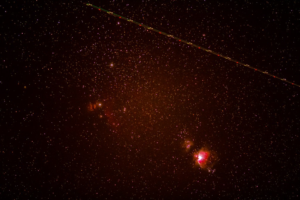
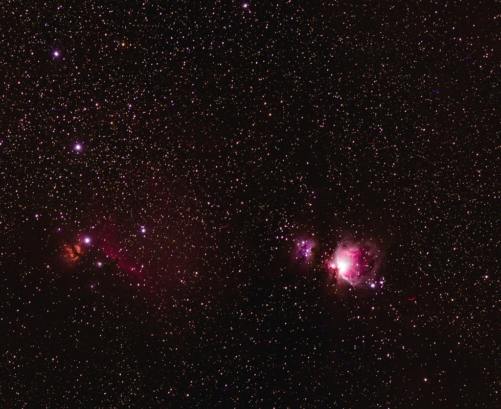
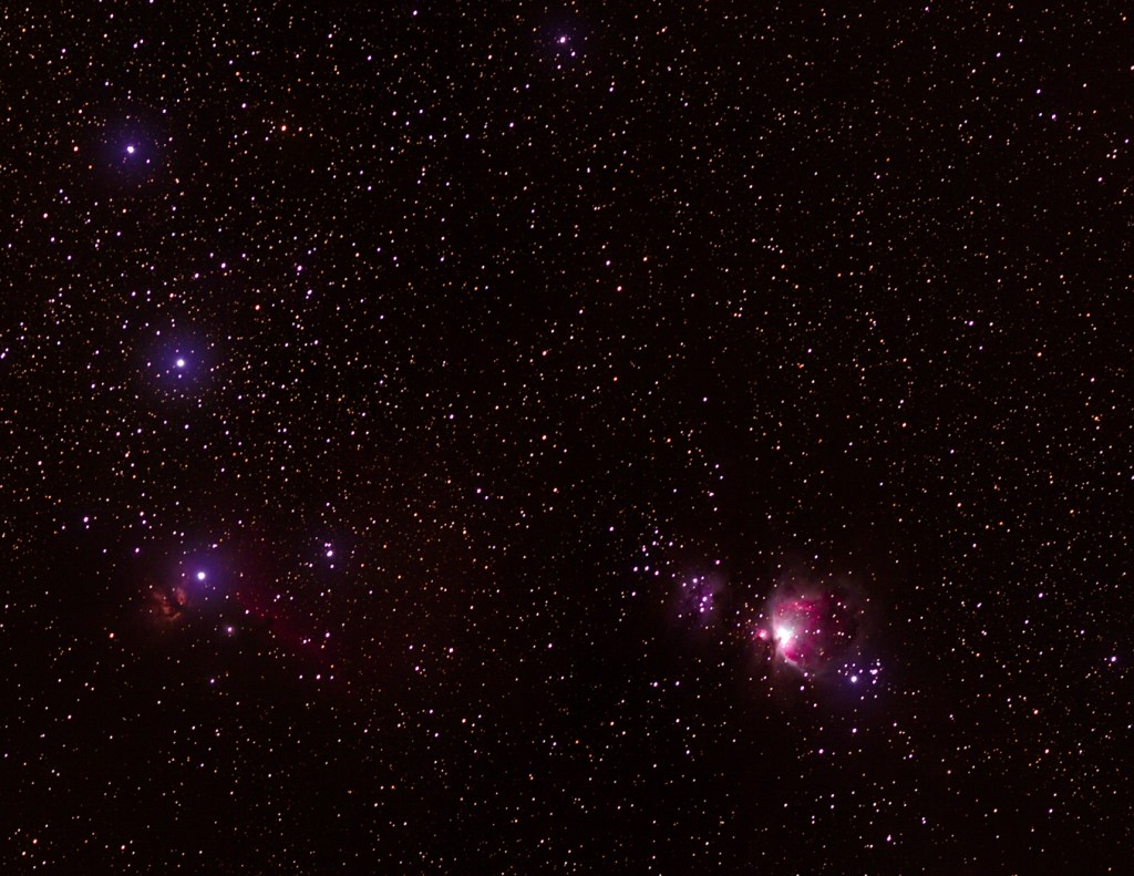
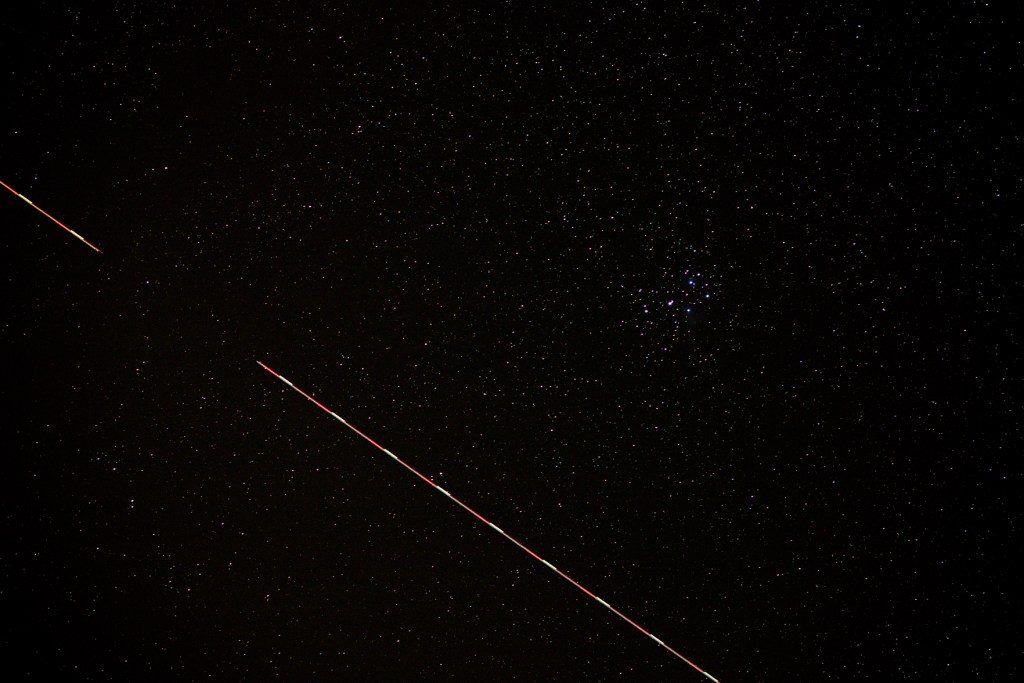
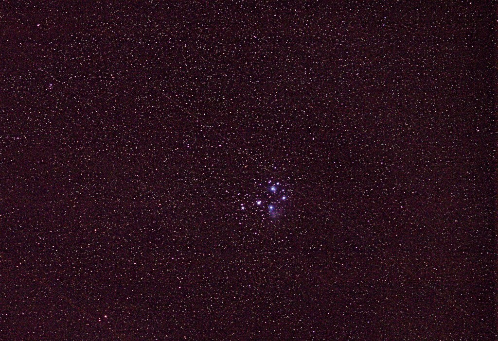
Last night I stood out in the cool crisp air taking 81 photos of the Constellation Orion and the Orion Nebula. This morning I composited these photos into two photos. These photos didn’t come out as well as I had hoped as I am still dealing with star trails, but I believe I’m getting better. I’m going to try again tonight and likely the next two nights trying different cameras and lenses in an attempt to determine what works best. Wish me luck!
Today my little boy Hopper passed over the Rainbow 🌈 Bridge. There are no words to describe how I feel right now. To say that I am heartbroken is an understatement. This little guy stole my heart ❤️ from the first moment we met. I’m never going to forget you “Little Buddy”. I Love You! I pray that someday we’ll be together again.
Yesterday my friend Robert and I got out and stretched our legs and got some fresh air while hiking the nearby Fall River Trail. This trail is 4.6 miles long through a heavily wooded, conifer forest. We enjoyed the views of the Deschutes River, Fall River and Fall River Falls. In addition, the fall colors are clearly on display now. Take a look!
The Deschutes River.The Deschutes River.Fall River.Fall River.Fall River.Fall River.Fall River Falls.Fall River Falls.Fall River.The Deschutes River.
Recently I have been trying to use my star tracker without any good results. My star tracker did not come with any instructions, so yesterday I went onto the manufacturers website to see if it had any tutorials that may help with my learning. As it turns out, it does. My star tracker was made in China and as most of us know, Chinese instruction manuals are generally poorly written, so it’s probably good that it didn’t come with one. So I spent most of the day yesterday learning about my star tracker and how it works. In addition, I recently added another lens to my camera bag. This lens, comes highly recommended by other astrophotography enthusiasts. Last night I tried out what I learned and my new lens.
I started out trying to get photos of the Andromeda Galaxy. Unfortunately, even with an app on my phone showing where things are in the night sky, I was not able to find it. So I moved on to the Pleiades (Seven Sisters) star cluster. I was able to get some good photos of Pleiades. Some of these photos even have jet trails. It’s amazing to me how many planes fly through eastern Oregon, especially at night. I tried to get some good photos of Jupiter too, which is very bright in the night sky right now, but they didn’t come out well. I’m going to keep trying. Take a look at the three photos below and let me know what you think.
Yesterday, Barbara, Hopper and I traveled north, across the Columbia River, into southern Washington, to visit Beacon Rock State Park. Beacon Rock is the remnant of an extinct volcano. While Barbara and Hopper enjoyed the picnic area I hiked to the top of Beacon Rock. That wasn’t my original plan as the hike appeared more difficult than I thought. The hike is 1.5 miles round trip with an elevation gain of 574 feet. My original plan was to hike to the river side of the rock, take some photos of the Columbia River and then hike back. However, the hike wasn’t as difficult as I thought so I continued to the top. I’m really glad I did as the view up there was incredible.
Beacon Rock from across the Columbia River.The trail.The Columbia River.Looking east, up the Columbia River Gorge.Looking north.Looking west, down the Columbia River Gorge.More trail, looking down.
On Wednesday Barbara and I took Hopper and drove the 146 mile long Mt. Hood Scenic Loop. This is a beautiful drive that circles Mt. Hood, goes through the Columbia River Gorge, stops at Bonneville Dam and took us to Multnomah Falls.
We started by heading east towards Timberline Lodge on the south slope of Mt. Hood. This is a ski lodge where the movie The Shinning, staring Jack Nicholson, was filmed. This was a big disappointment. If you pay to stay in the lodge you can park adjacent to the lodge. The cheapest room here is $210/night. If not, you have to park at the bottom of the hill and walk up. Unfortunately, Barbara couldn’t make that walk so we weren’t able to do anything but take a few photos and leave. From there we continued northeast to Panorama Point in the town of Mt. Hood. In Mt. Hood we noticed a river boat parked in the marina, so we decided to go check it out. After exploring the river boat and marina we headed west on I-84 to Bonneville Dam and their visitor center. At the visitor center we enjoyed a movie describing the history of the dam. We checked out the fish ladder, had lunch and enjoyed the view. After leaving the dam we traveled down highway 30 to Horsetail and Multnomah Falls. These falls are beautiful. After hiking around this area and taking lots of photos we headed back to the trailer. If you’re ever staying in the area I recommend exploring this scenic loop.
Mt. Hood.Timberline Lodge.Looking south from Mt. Hood.Nice truck!Mt. Hood from Panorama Point.The river boat.The Mt. Hood marina.This is from the original turbine at Bonneville Dam.The fish ladder.Bonneville Dam.Bonneville powerhouse and locks.Horsetail Falls.Horsetail Falls.Multnomah Falls.Multnomah Falls.Multnomah Falls from the bridge in the previous photos.A view of the Columbia River from the bridge.
Today I decided to take an easier trail so that I could just enjoy the view. The Trillium Lake Trail is listed as a 1.9 mile loop. Unfortunately, the trail is closed along the backside of the lake for repairs. Even though, I managed to make it into a three mile hike. The views, as you can see below, are breathtaking with Mt Hood reflecting off of Trillium Lake.
Yesterday I was checking out the All Trails app on my phone looking for a moderate trail in the vicinity of Mt Hood where I might be able to get a good view of Mt Hood. I believe my days of hiking the difficult trails are over. I found the Mirror Lake Trail which is rated as a moderate trail and 4.2 miles long. So this morning I grabbed my camera, some water and some trail snacks and took a hike. This is a great trail with lots of scenery that makes the tough parts of the trail worth the effort. As usual my hike ended up longer than advertised, 5.4 miles, because I like taking side trails to see what else I may discover. Take a look at the photos and enjoy the beauty that I enjoyed today.
The trail.Mirror LakeMt Hood peaking through the trees.Mirror Lake with Mt Hood in the background.
Last Tuesday my puppy woke me up early because he needed to go out. While outside with him I noticed the colorful sunrise, so I grabbed my camera and took a few photos of the colorful sky above the Columbia River. Take a look!
This past Sunday Barbara, Hopper and I travelled to the east end of Lake Coeur d’Alene to the Mineral Ridge Recreation Area. While Barbara and Hopper enjoyed the fresh air at the picnic area I took a hike to stretch my legs and lungs to the top of Mineral Ridge. The sign indicated that the trail is 2.5 miles long, but as usual I took a couple of side trails and extended my adventure by another 2.5 miles. This is a beautiful and in places a difficult hike, but I thoroughly enjoyed the chance to get out in nature, the fresh air and the much needed exercise. Back in the early 1900’s prospectors tried mineral exploration in the area, thus the name, but could never make it profitable.
Trail to Mineral Ridge.Milkweed thistle.Check out the colorful rock to the right.The Wilson Trail.Fall colors along the Wilson Trail.A vista of Lake Coeur d’Alene with I-90 to the right.Looking east.