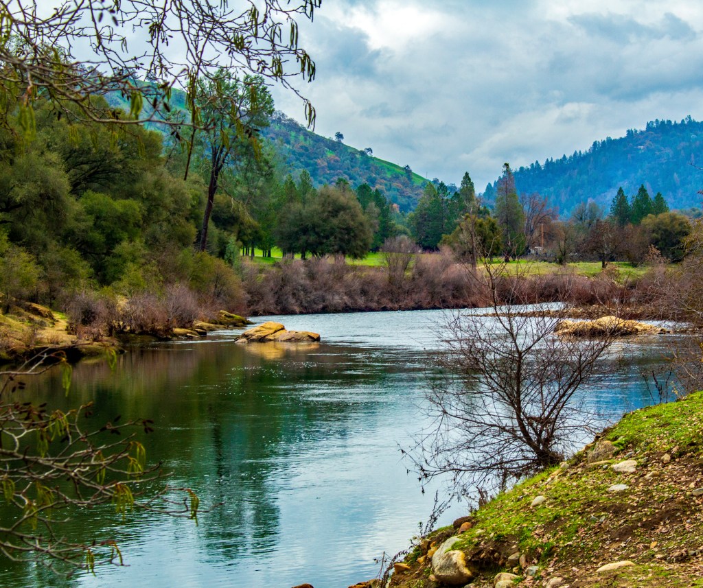
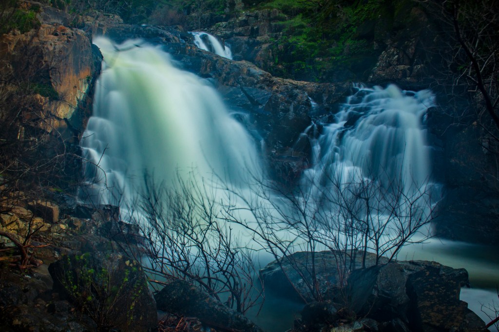
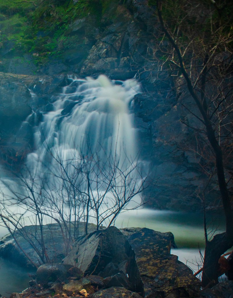
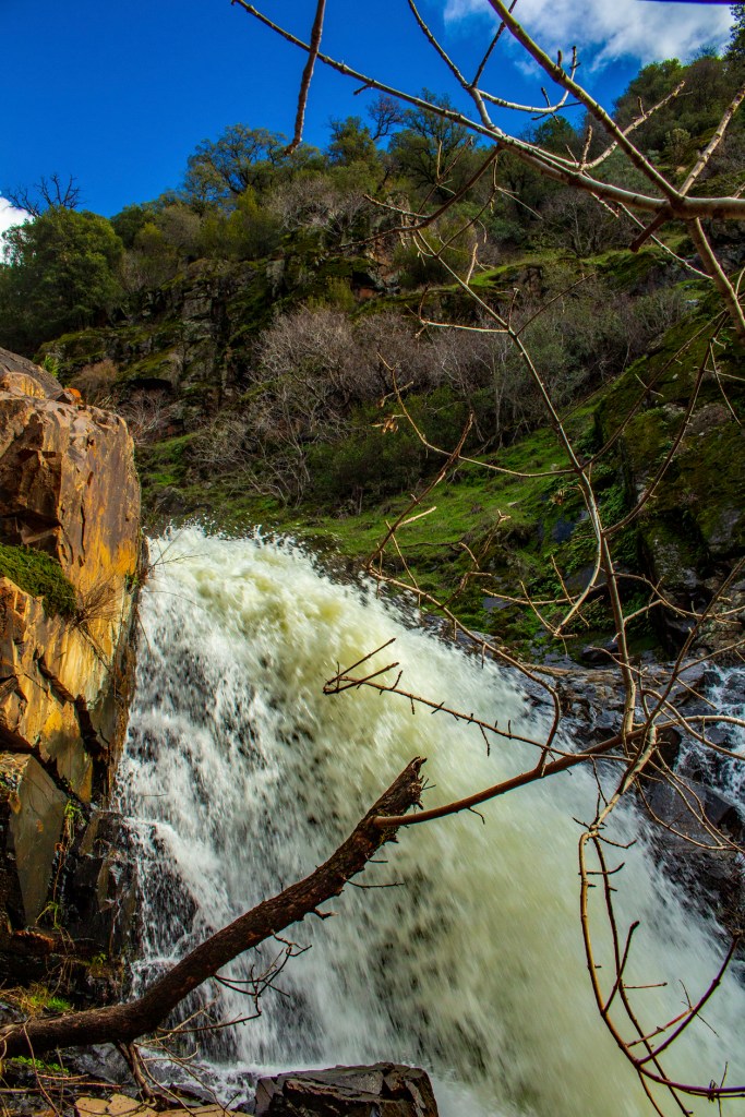
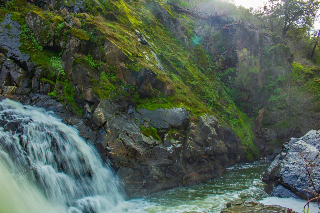
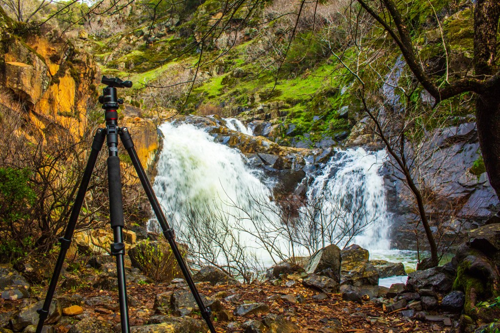
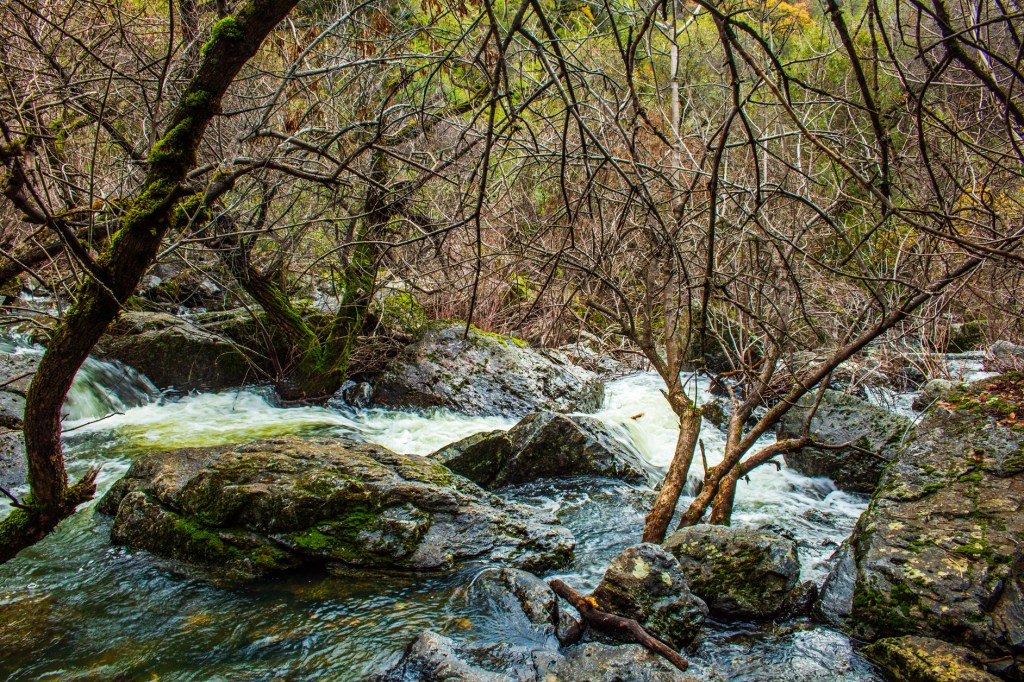
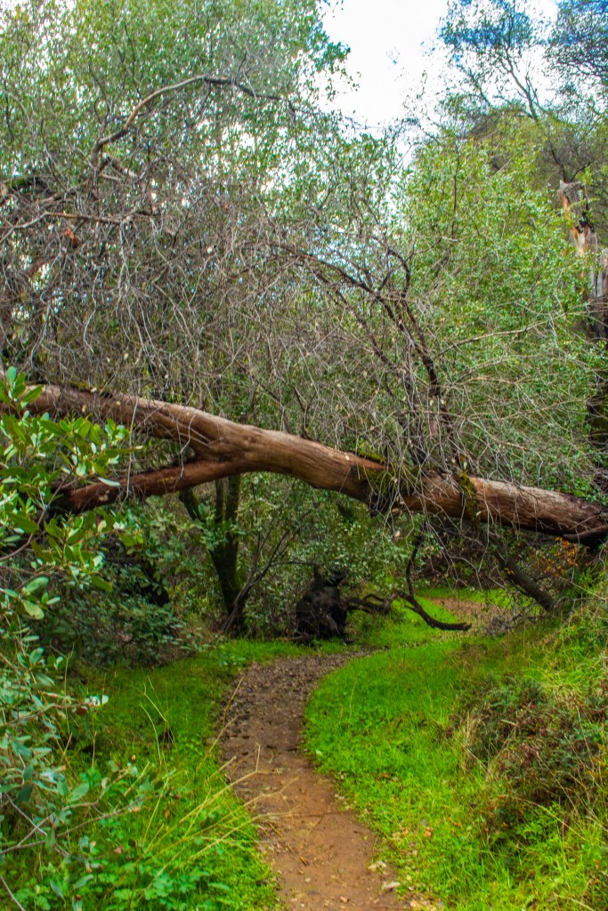
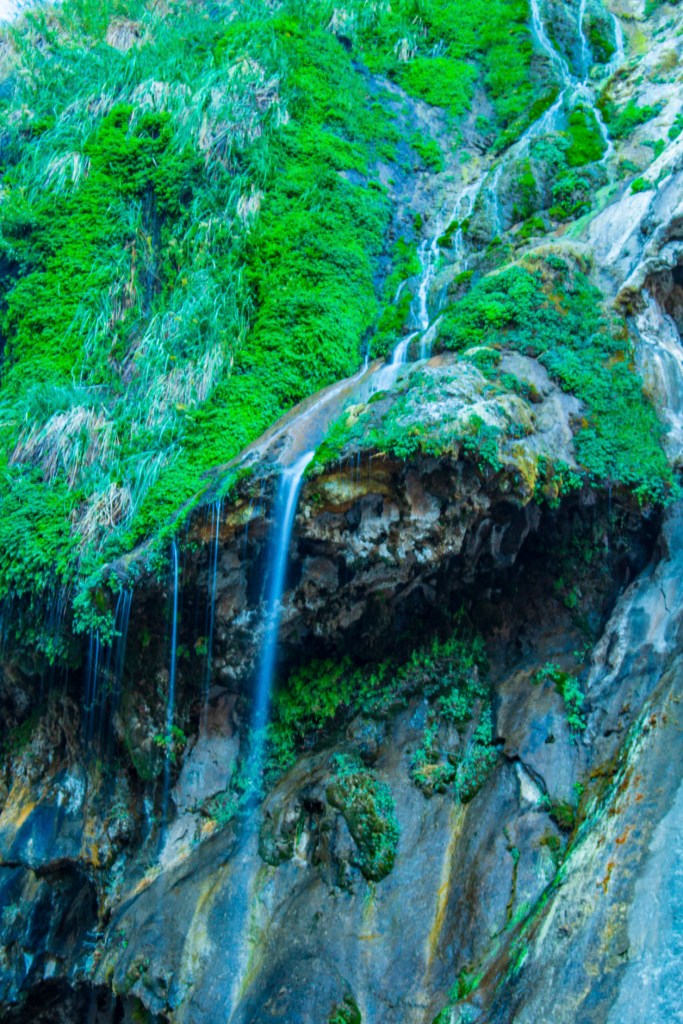
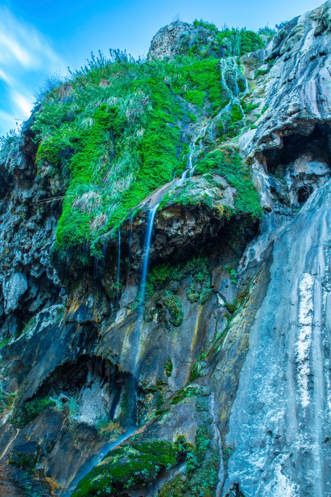
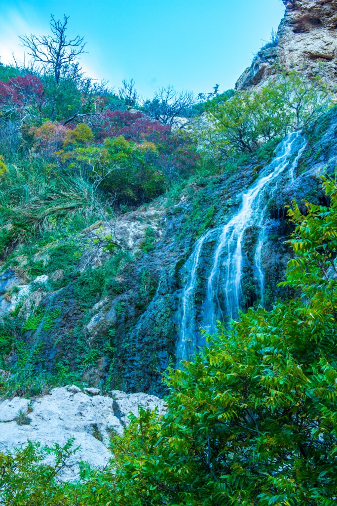
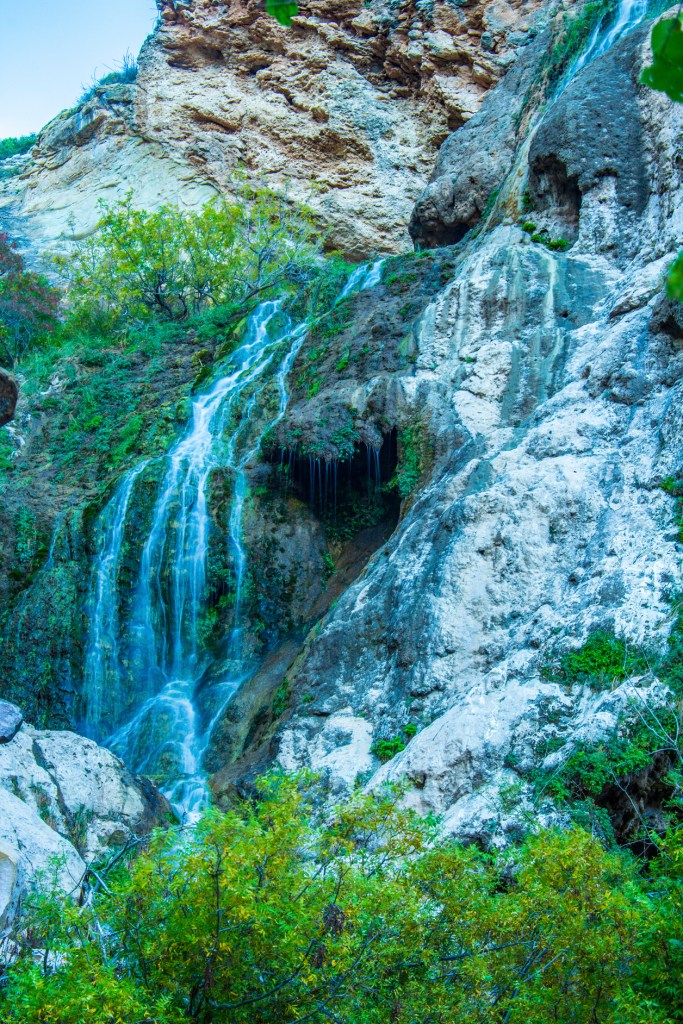
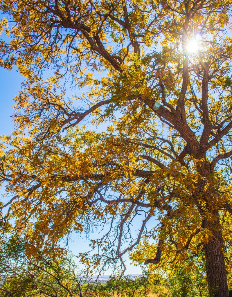
Yesterday the rain finally subsided so I checked out the AllTrails app on my phone to see if there were any trails in the Coloma area that I haven’t hiked. As it turns out there is a trail, not too far from camp, that has a nice looking waterfall and with the recent rains I figured it would be flowing real well. It’s been awhile since I have had a chance to get out and shake some of the rust off of this tired old body. The trail to the falls is rated as moderate, but the last 2 tenths of a mile kicked my butt. I made it and the hard work paid off. All in all my hike was 8.1 miles roundtrip, but it felt great to get out and enjoy the scenery and fresh air.
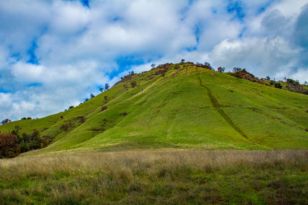
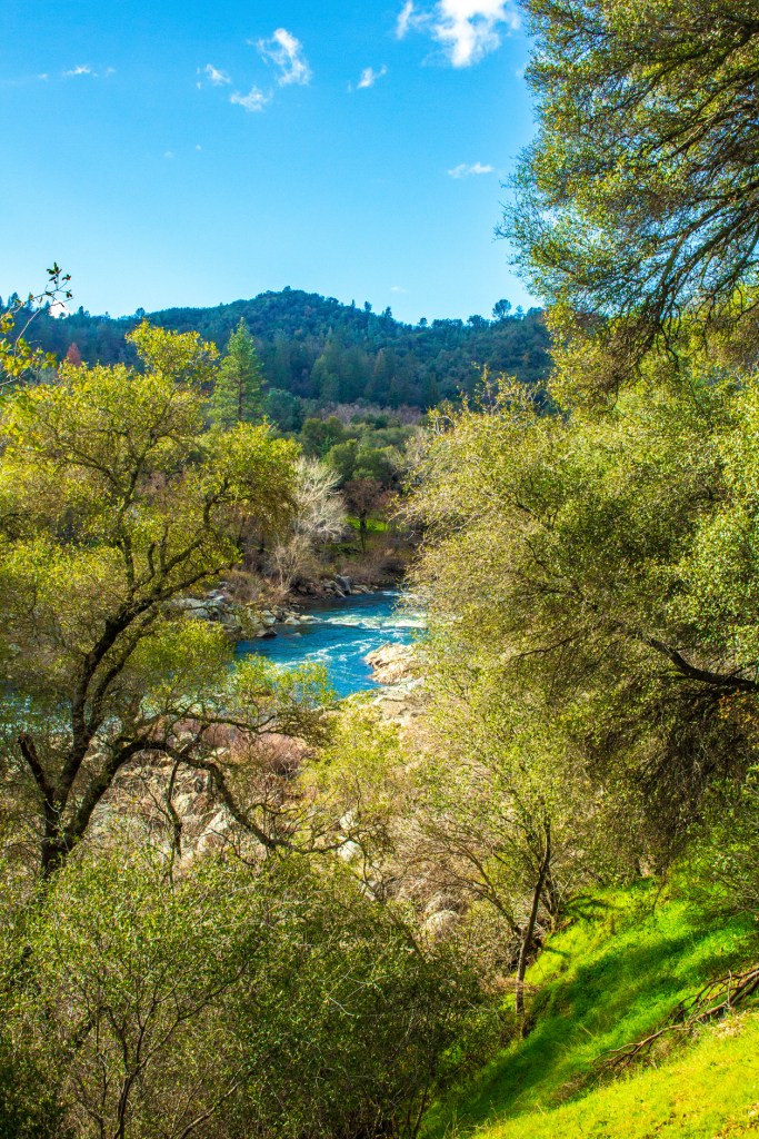
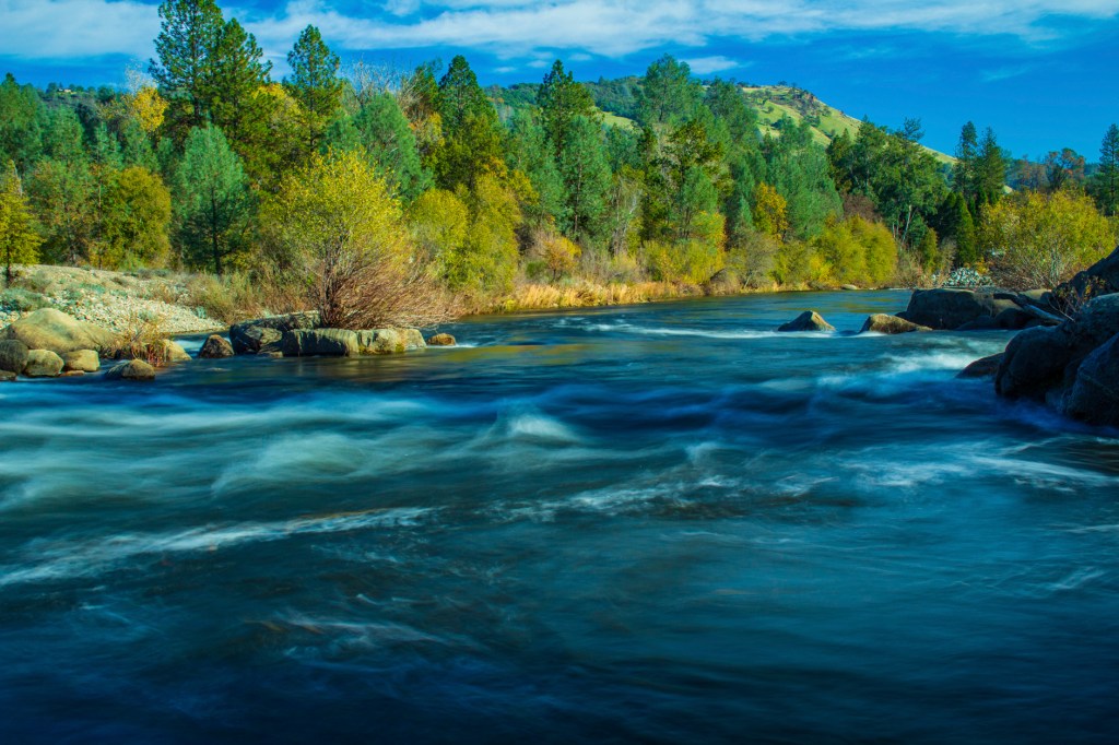
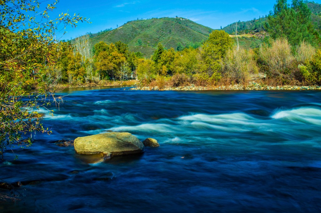
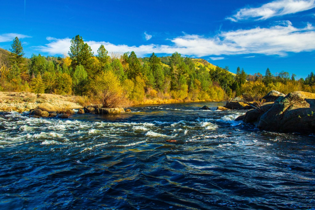
The south fork of the American River.Mt. MurphyJohntown Falls The water was running so hard that it was kicking up a lot of mist. To get these photos I had to frequently wipe off the front of my lens. Johntown FallsJohntown FallsJohntown Falls and Dutch Creek.Dutch CreekThe trailThe American River
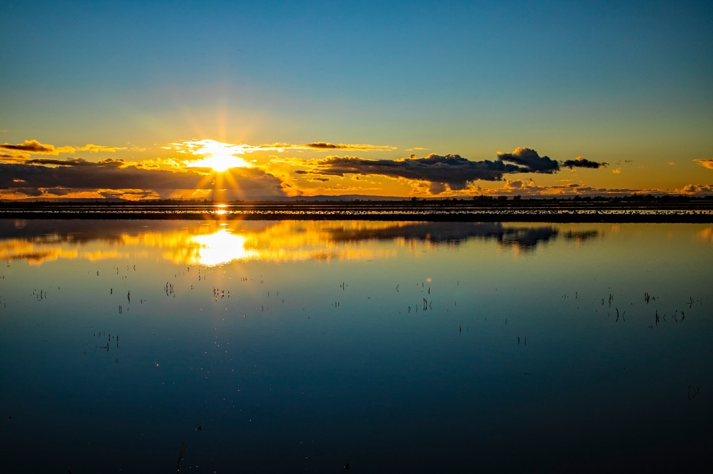
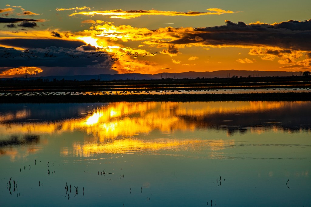
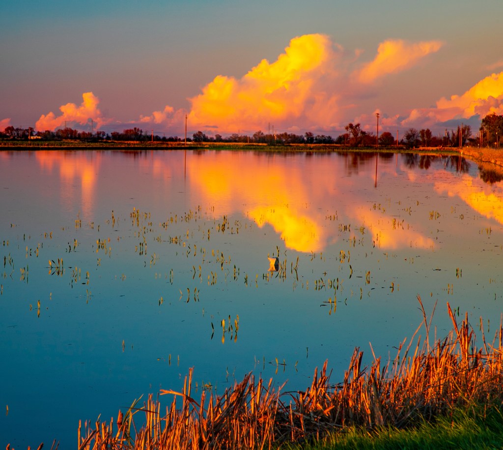
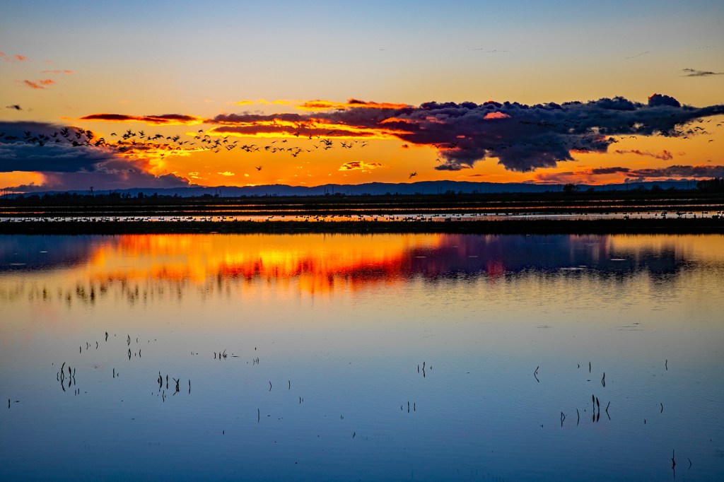
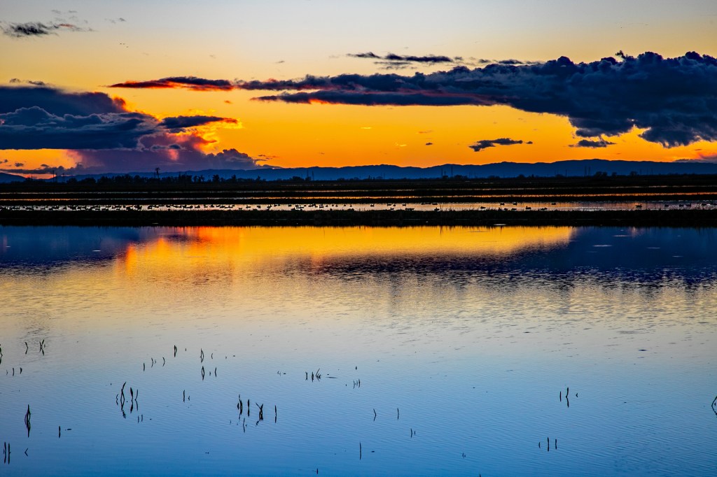
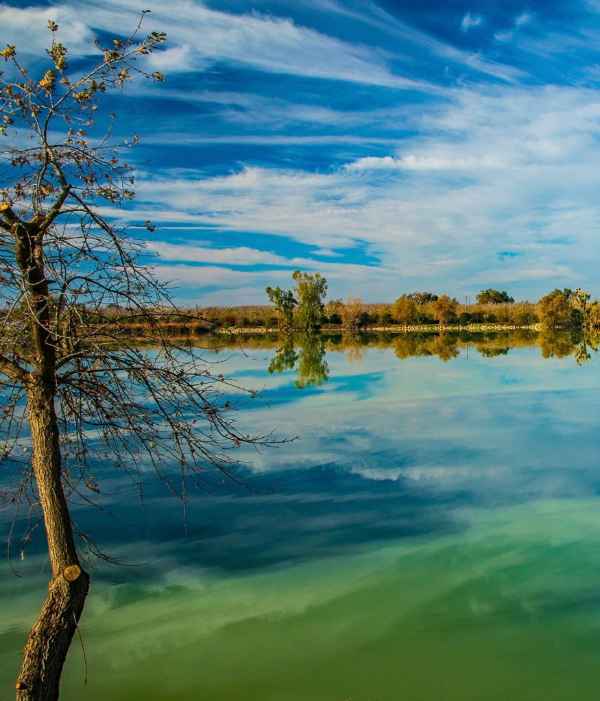
On Wednesday I drove a few miles to the east to take advantage of the local farmland, the waterfowl on the Pacific Flyway and the evening sunset. I wasn’t disappointed. In this area the farmer’s fields are filled with water, there are plenty of waterfowl enjoying the fields, and with the rain earlier in the day there were enough clouds to provide contrast in the sky. In addition, the coastal mountains provided a nice backdrop. Take a look!
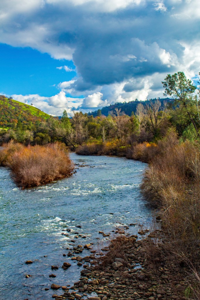
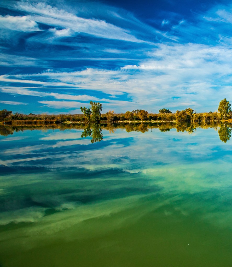
Barbara and I landed in California just before Thanksgiving and have not been feeling well since. Approximately 10 days ago we were both diagnosed with Covid-19. Due to this I have not been taking any photos and have not been posting to my blog. I did get out and take a few photos before I got sick and then again today. I am feeling much better and Barbara is on the mend. The photos I took this morning at Lake Minden almost look like oil paintings. Take a Look!
The American River.The American River.The American River.Lake Minden.Lake Minden.
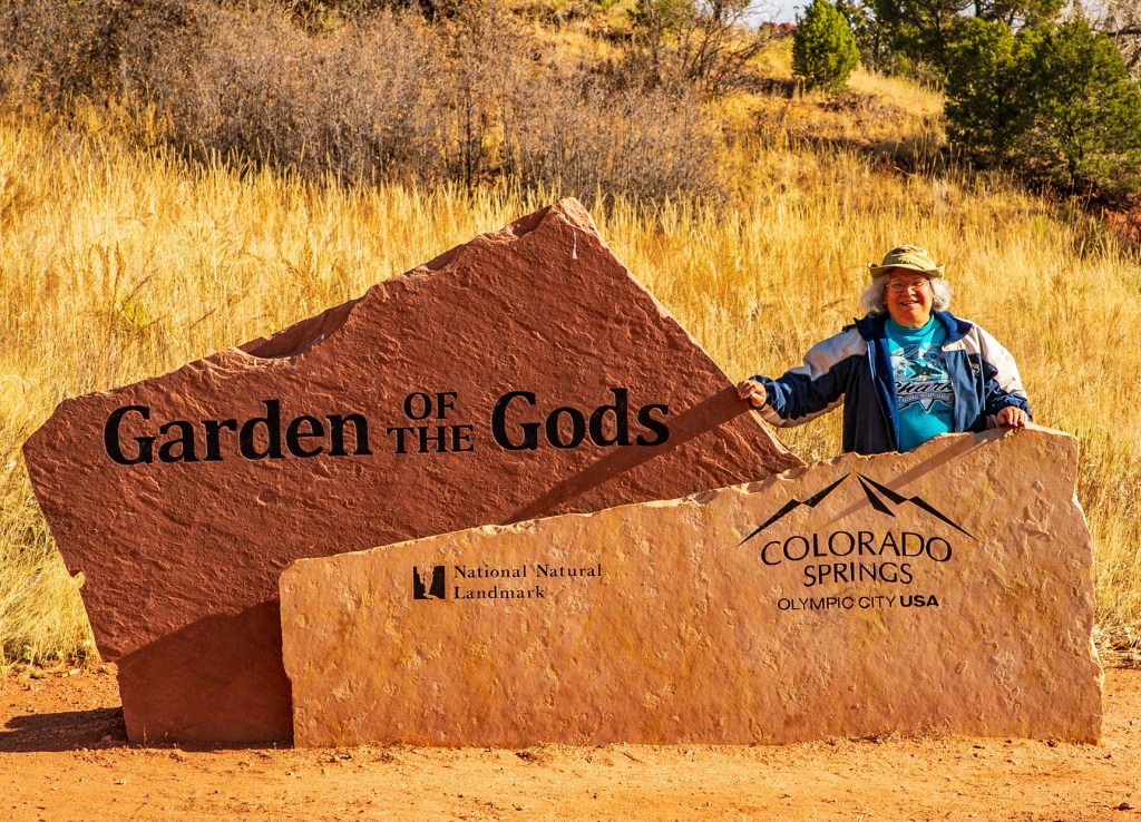
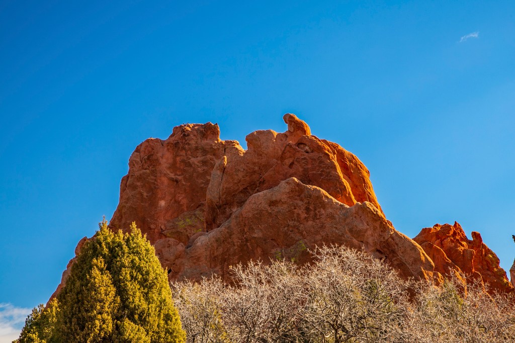
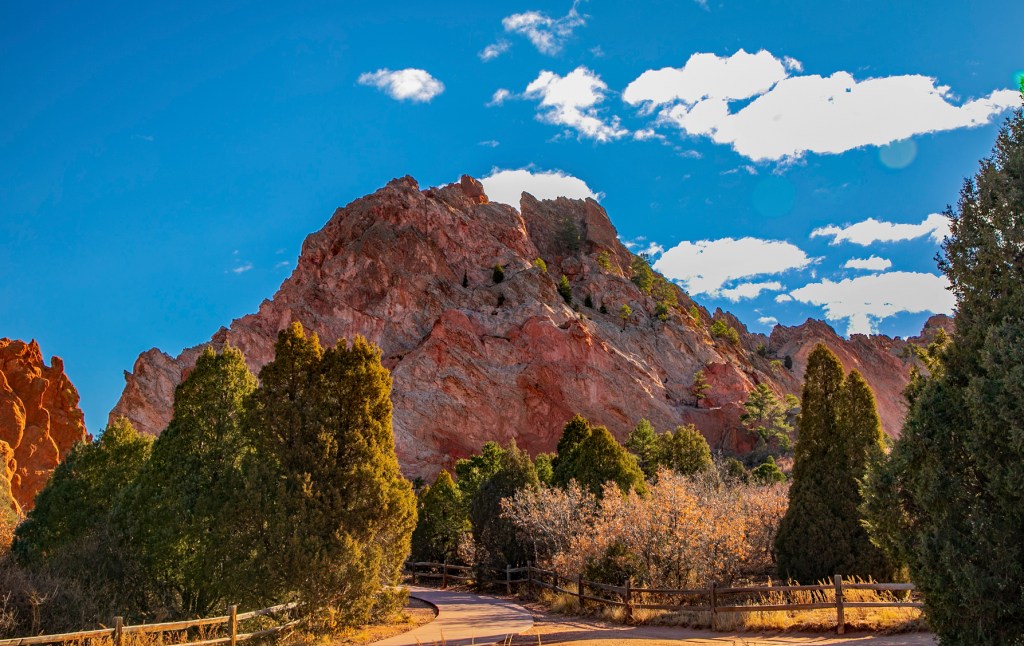
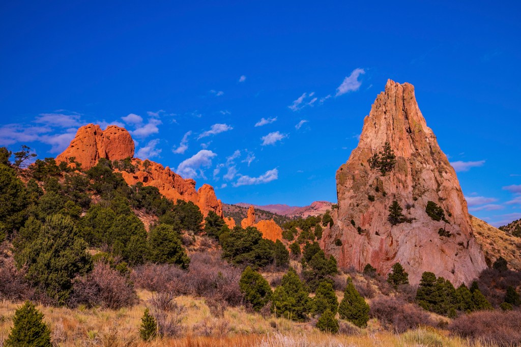
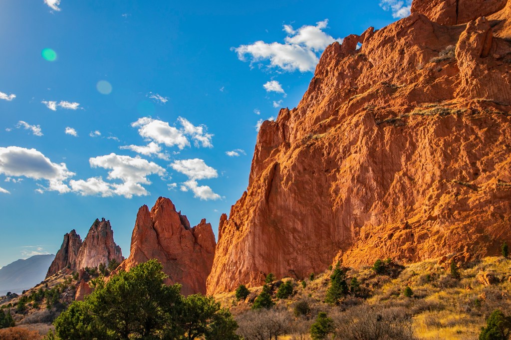
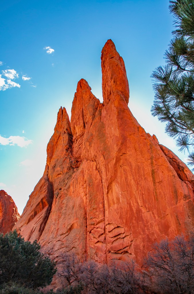
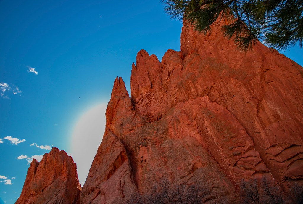
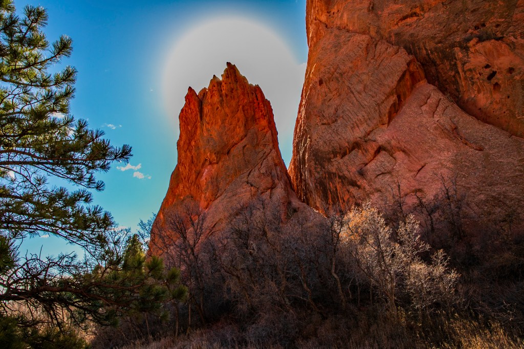
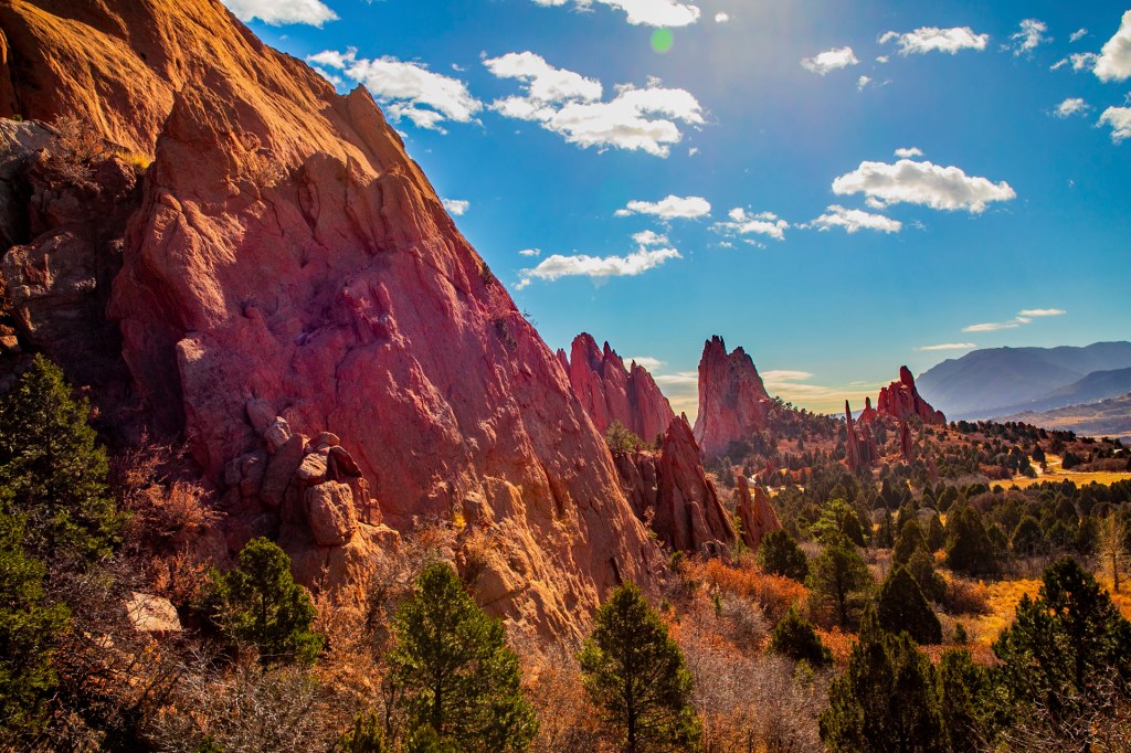
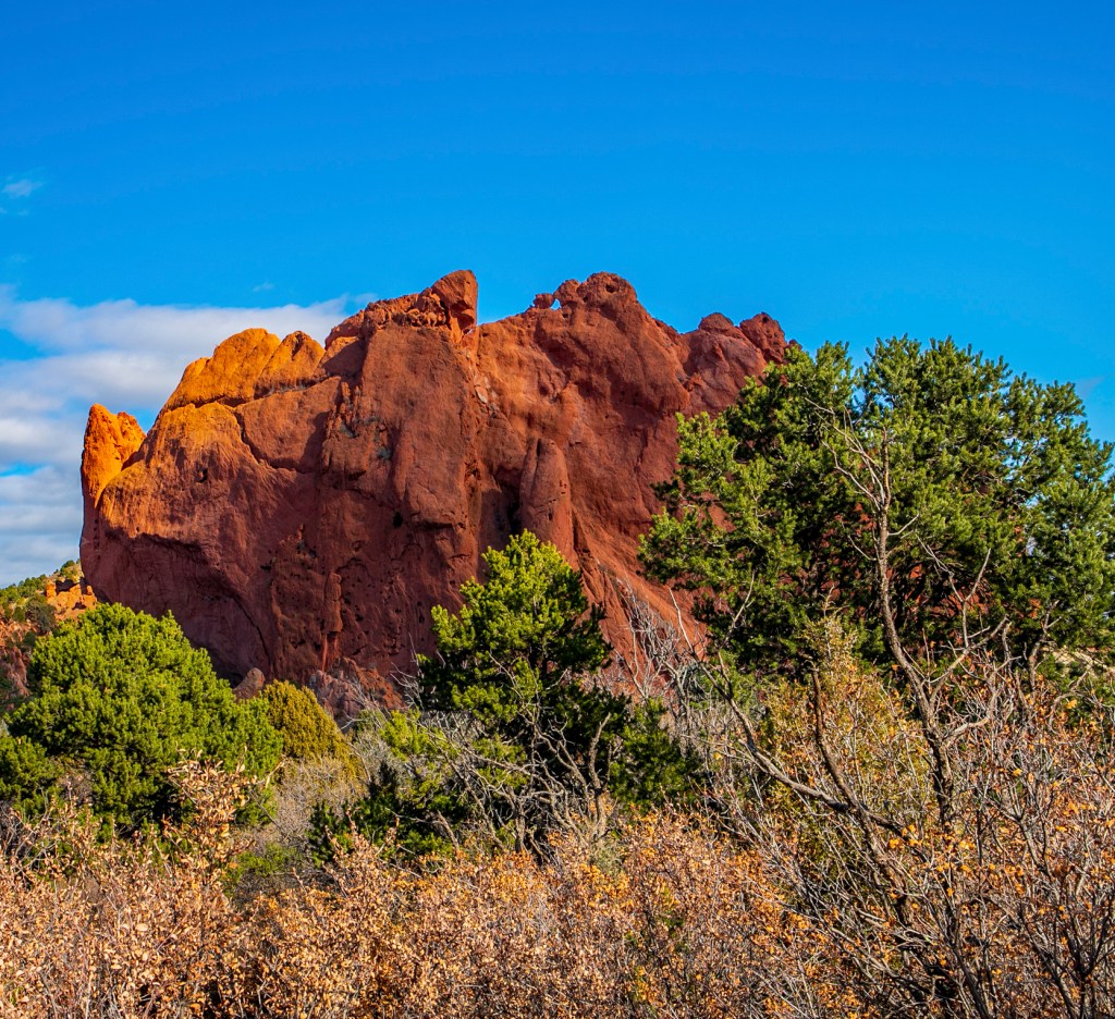
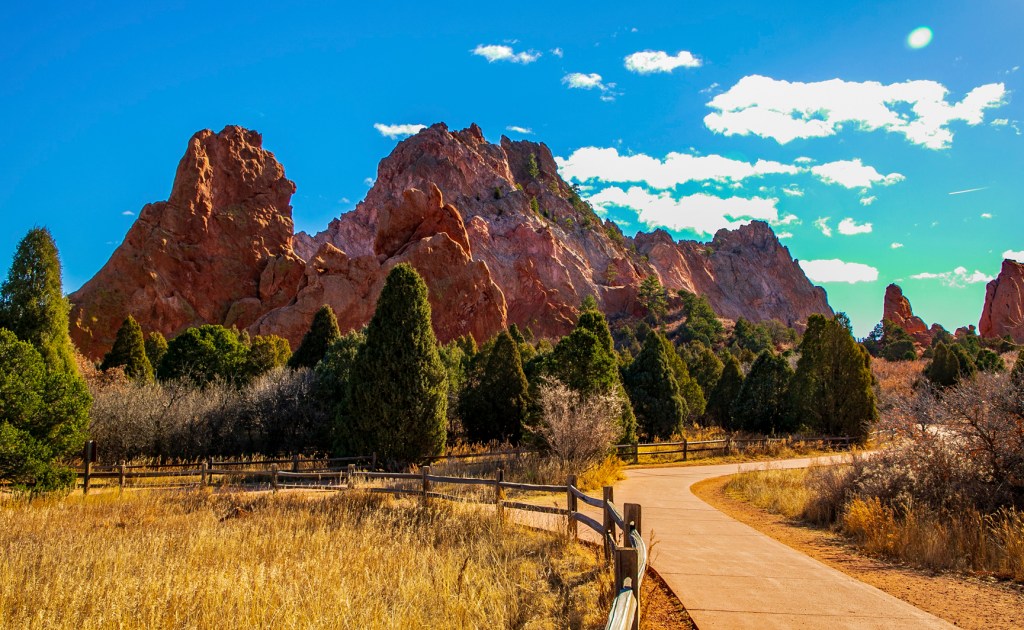
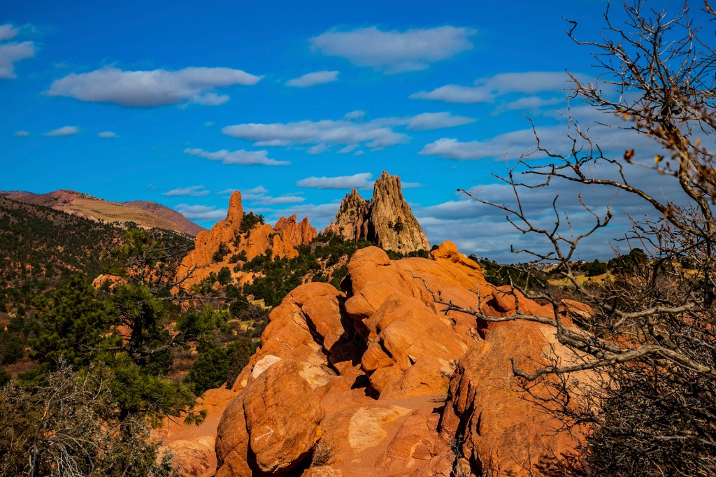
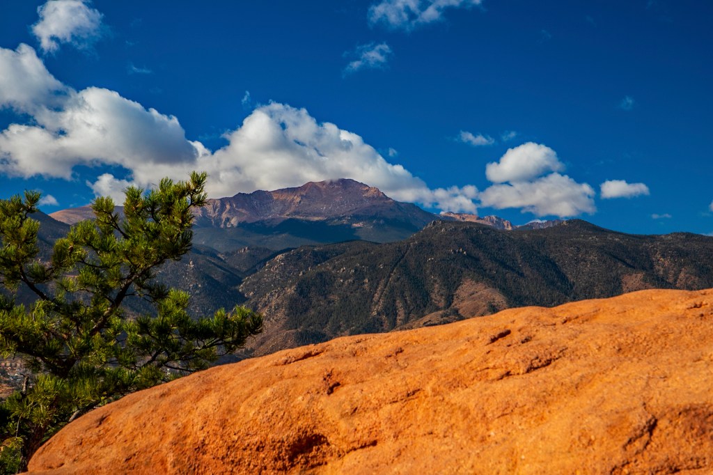
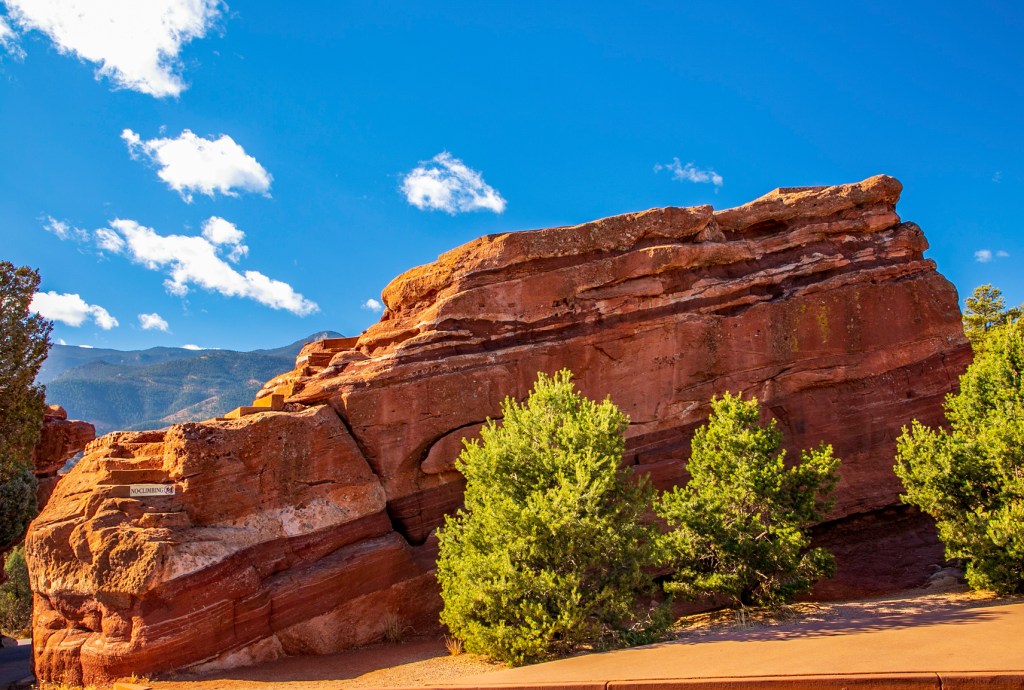
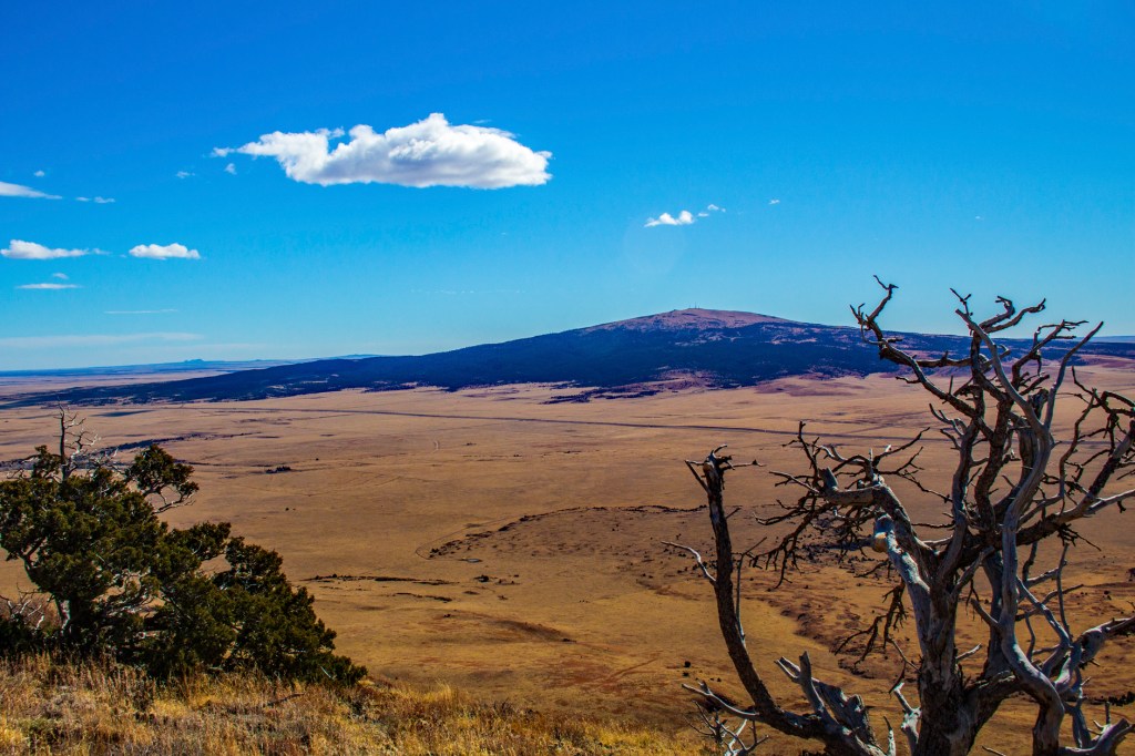
This morning Barbara and I decided to brave the cold and visit the Garden of the Gods. As it turned out it was a good call. The last time we visited the park there were so many people that in most places we couldn’t find a parking spot and when we could there were so many people getting good photos was difficult. When we started this morning the temperature was 34 degrees and it topped out at 37 degrees. Not exactly t-shirt weather.
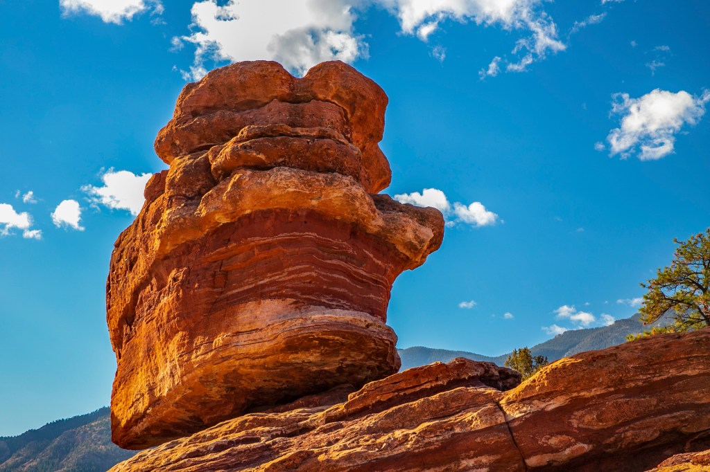
The outstanding geologic features of the park are the ancient sedimentary beds of deep-red, pink and white Pennsylvania age sandstone, conglomerate and limestone that were deposited horizontally, but have now been tilted vertically and faulted into “fins” by the immense mountain building forces caused by the uplift of the Rocky Mountains and the Pikes Peak massif during the Laramide Orogeny. The movement of ice during the Ice Ages (Pleistocene Epoch) resulted in erosion and glaciation of the rock, creating the present rock formations. Evidence of past ages can be read in the rocks: ancient seas, eroded remains of ancestral mountain ranges, alluvial fans, sandy beaches and great sand dune fields.
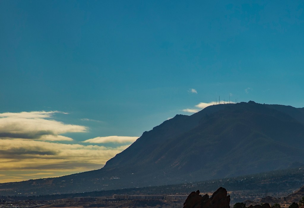
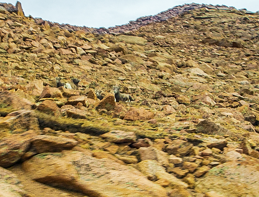
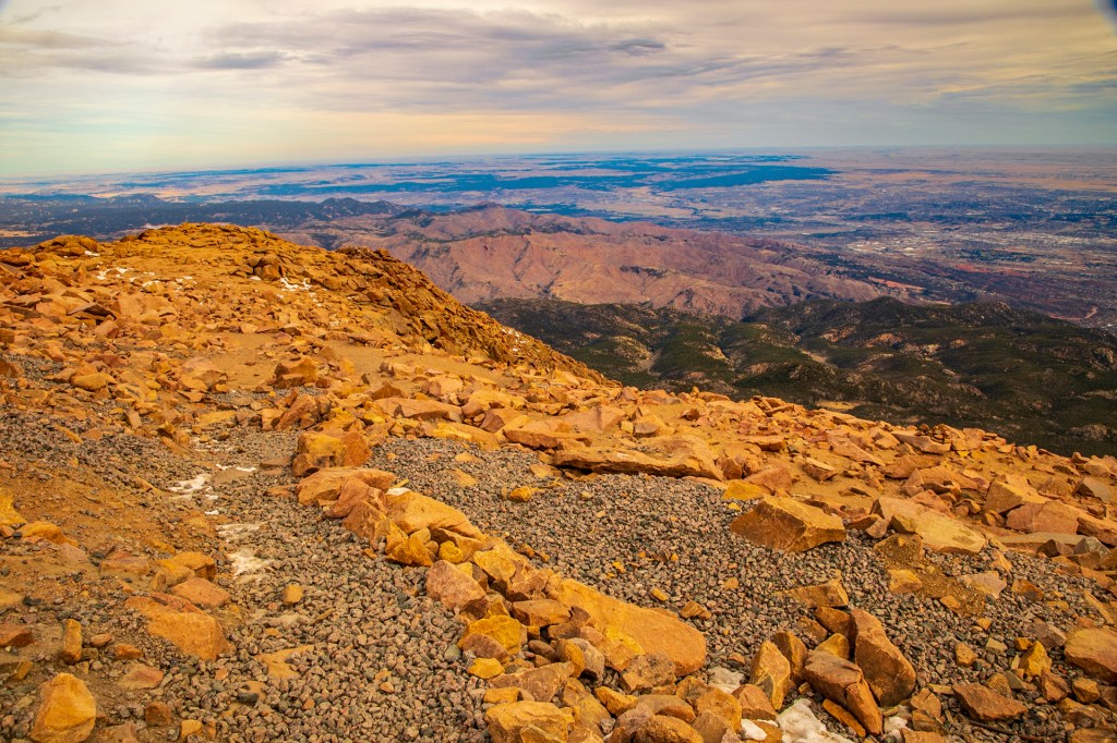
Balance RockPikes PeakKeyhole Window to the left. Sleeping Giant to the right.Cheyenne Mountain the home of NORAD.Cathedral SpiresKissing CamelsCathedral SpiresPikes PeakShip Rock
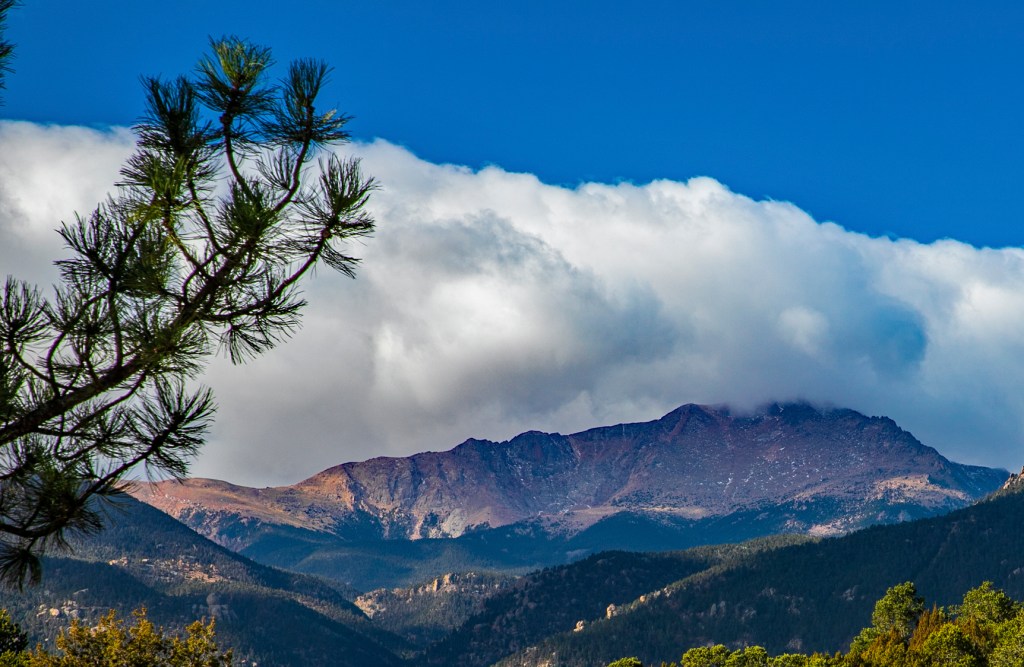
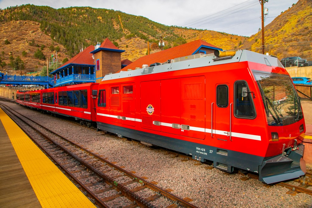
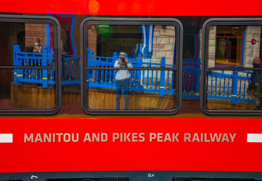
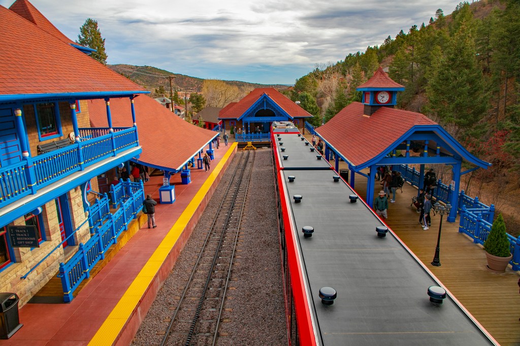
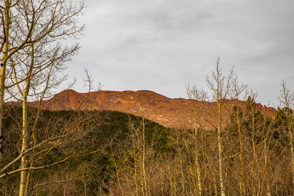
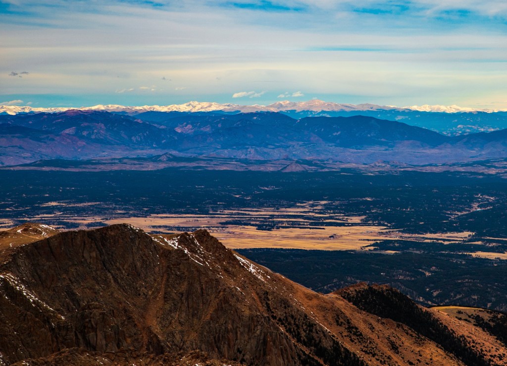
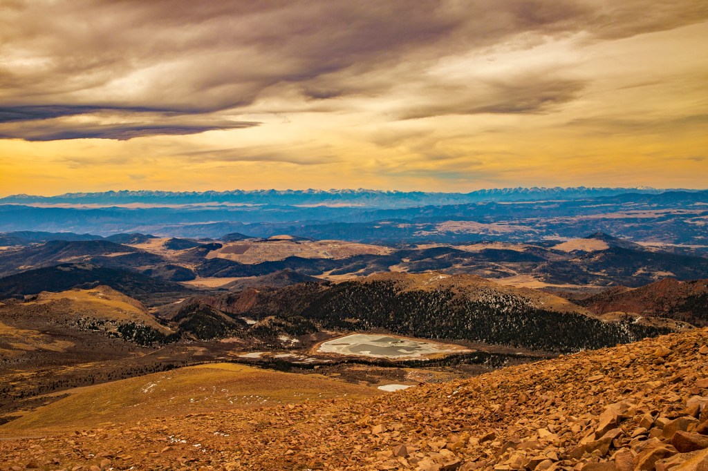
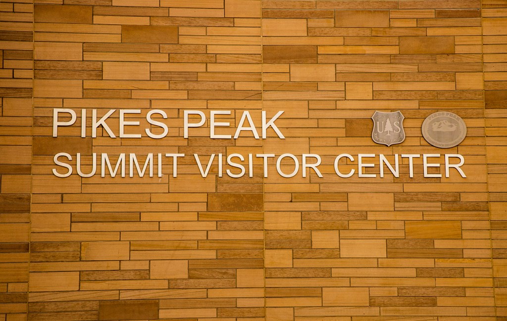
This morning Barbara and I took the cog-train to the top of Pikes Peak. Pikes Peak is my favorite place in the entire world. I have been to the top every way a person can. I have taken the cog-train up, twice now, I have driven up and down the road more times than I can remember and I have even climbed the peak twice. In addition, I have ridden in a limousine to the top with my mom and one brother. What a ride. Back in 1975 and 76, I even worked the Pikes Peak Hill Climb, on July 4th, with my cousins. Great memories!
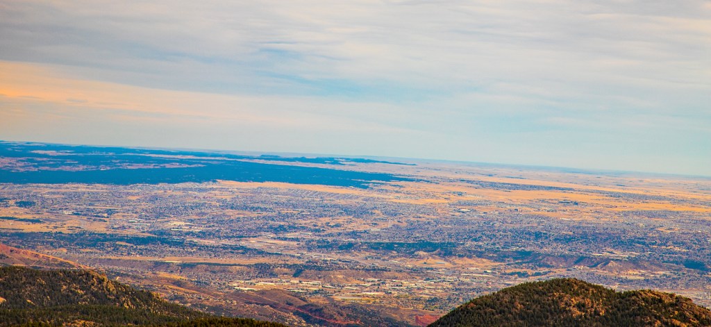
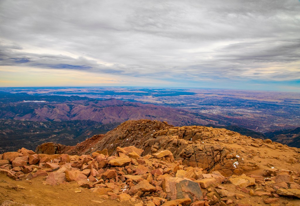
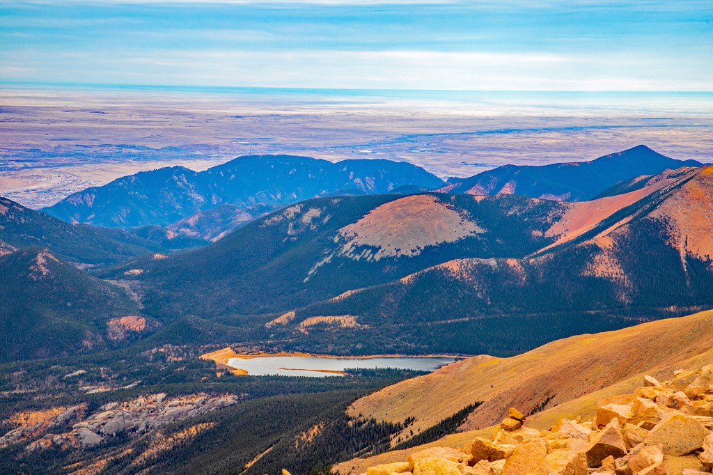
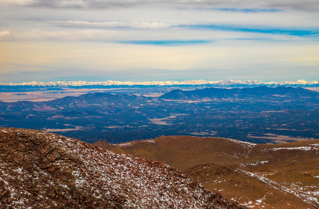
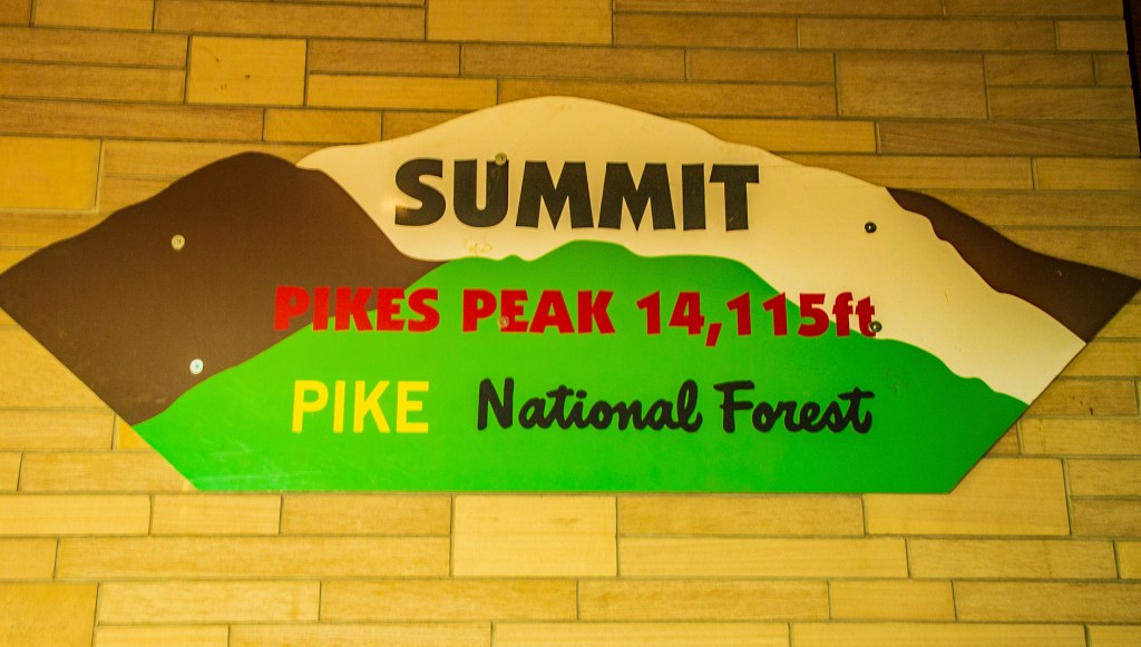
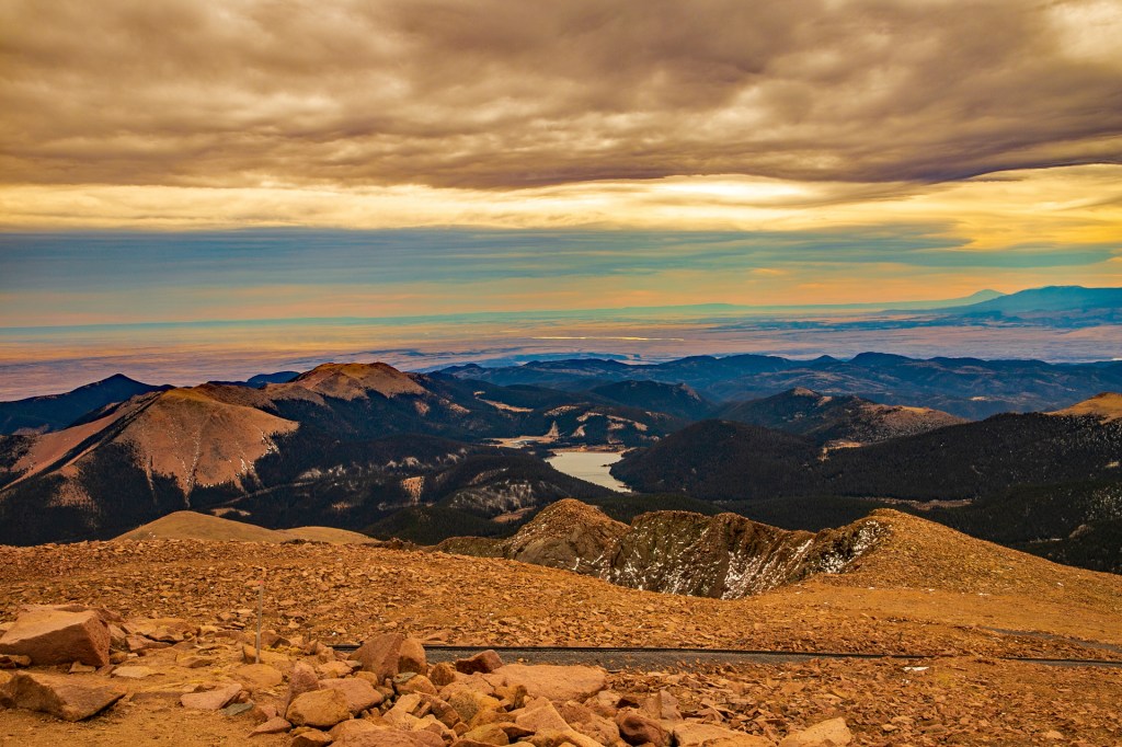
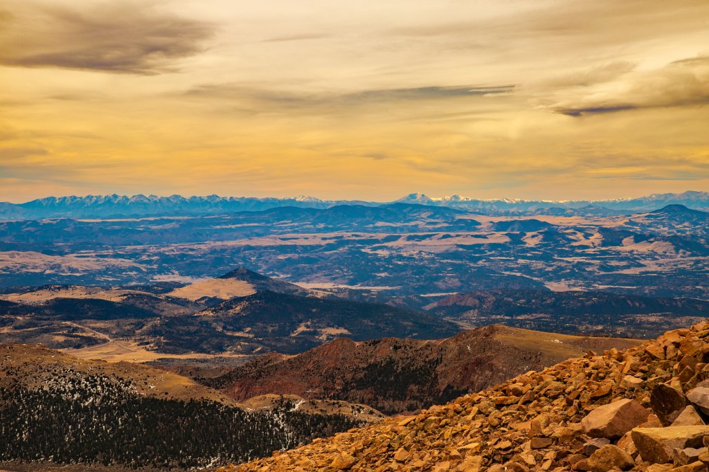
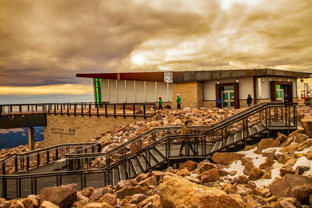
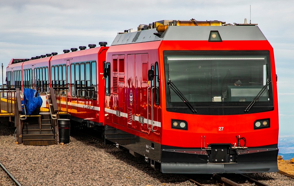
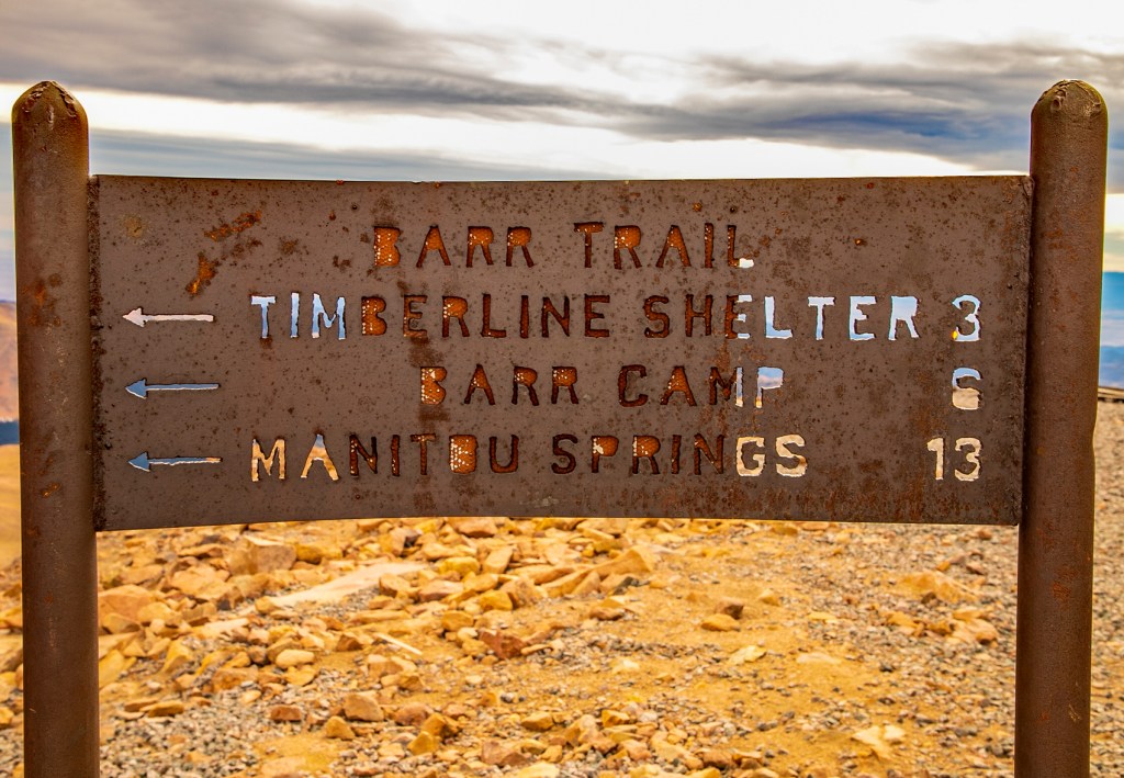
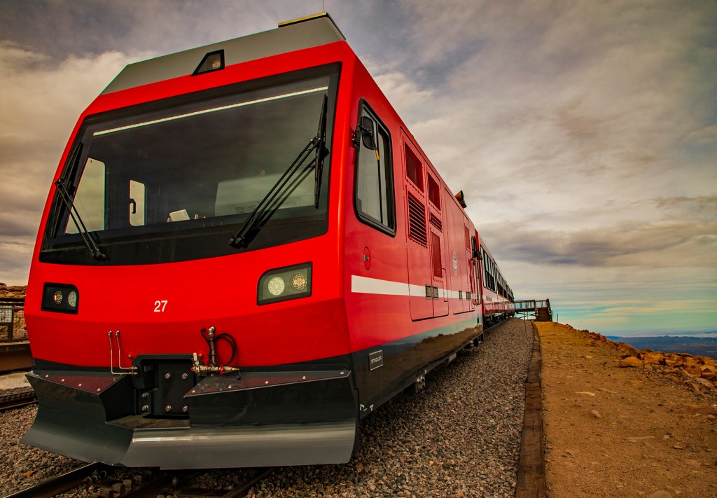
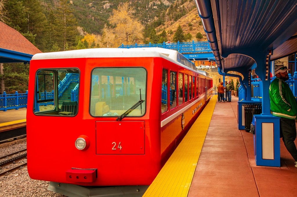
When we arrived at the summit this morning I was so excited that the wind and the cold didn’t bother me. At the summit the temperature was 25 degrees with a wind chill of 5 degrees, but I hardly noticed. I walked around the summit like I was walking on air. I felt at home as this is a place that always makes me feel that “Rocky Mountain High”. I took several photos, marveled at the views and then went into the summit house to enjoy a cup of hot chocolate with Barbara before the return trip to Manitou Springs. The trip to the summit is almost nine miles long, with an elevation gain of 1.5 miles and at one point the train climbs a slope of 25 degrees. The train uses between 60 and 70 gallons of diesel during its accent of the peak and less than one gallon on the decent back to Manitou Springs. I know that I am getting up in the years, but there is still that young man in me that hopes someday soon I will get the chance to scale the summit one more time. Back at the trailer I think to myself, when will I get the chance to go back to that place where I most feel at home?
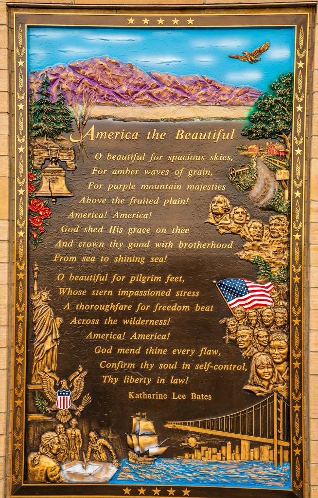
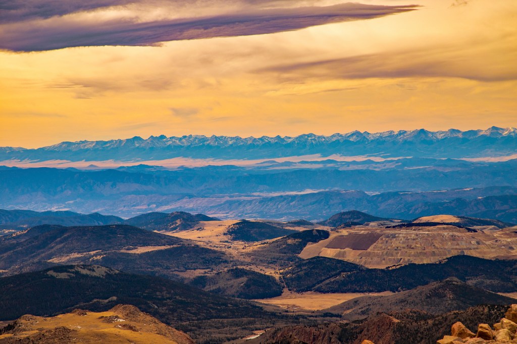
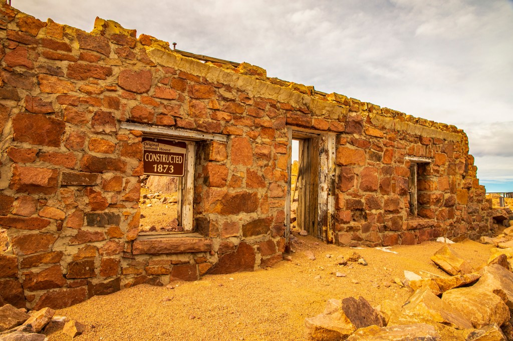
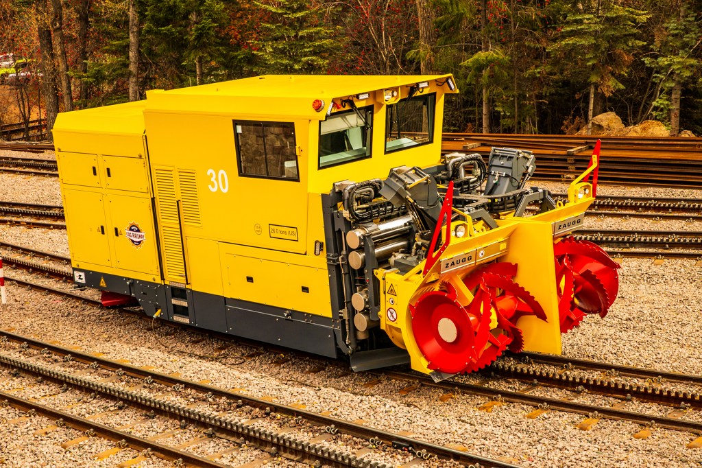
Our train at the Manitou Springs Station.Reflecting in my photo.The Manitou Springs station.The summit in view.Big Horn Sheep.The song America the Beautiful was written after a visit here.In the lower right of this photo you can see the Cripple Creek/Victor gold mine. This is the richest gold mine in the state of Colorado. This mine opened in 1890 and today it still extracts approximately 1,000 pounds of gold per day. The ore is in altered and brecciated volcanic and volcanoclastic rocks of Oligocene age and predominantly quartz latite composition. The Cripple Creek volcanic complex is surrounded by Precambrian gneiss, granite, and quartz monzonite. The gold occurs as disseminated micrometer-size free gold and as gold-silver tellurides, or telluride minerals. Gangue minerals include pyrite, quartz, and fluorite.The continental divide in the distance with a frozen lake in the foreground.The continental divide in the distance.The new summit house. It’s only been open since July. Our train at the summit.This is a welcome site when climbing the peak. It lets you know you made it. The feeling of accomplishment is amazing. The last few feet of Barr Trail before reaching the summit. The previous generation of cog-train. I rode this train in 1974. Their 26 ton snow plow.
This morning Barbara and I woke up to an outside temperature of 38 degrees. Due to this I had to break out my “Big Boy Pants”. I believe this is the first time this year I have had to wear long pants. This past winter we were in Florida where the temperatures ranged from 70 to 77 degrees night to day. And this past summer we were exploring the New England states, so there was no need for long pants.
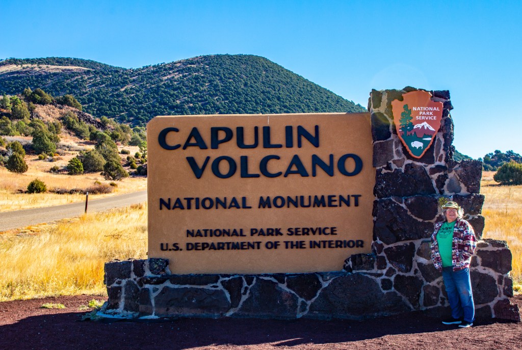
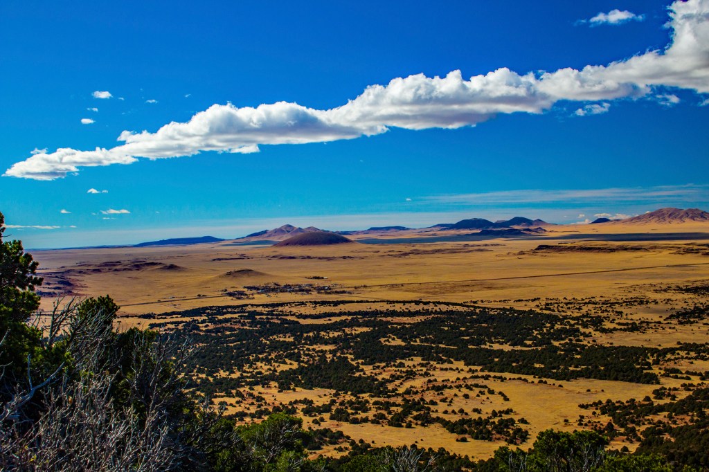
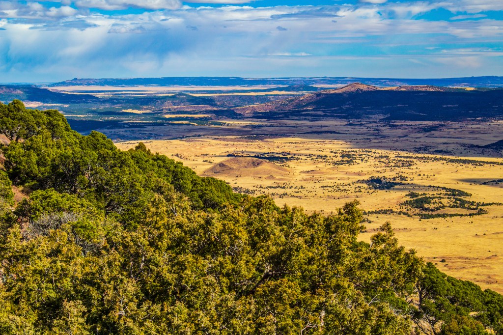
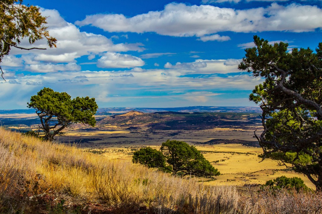
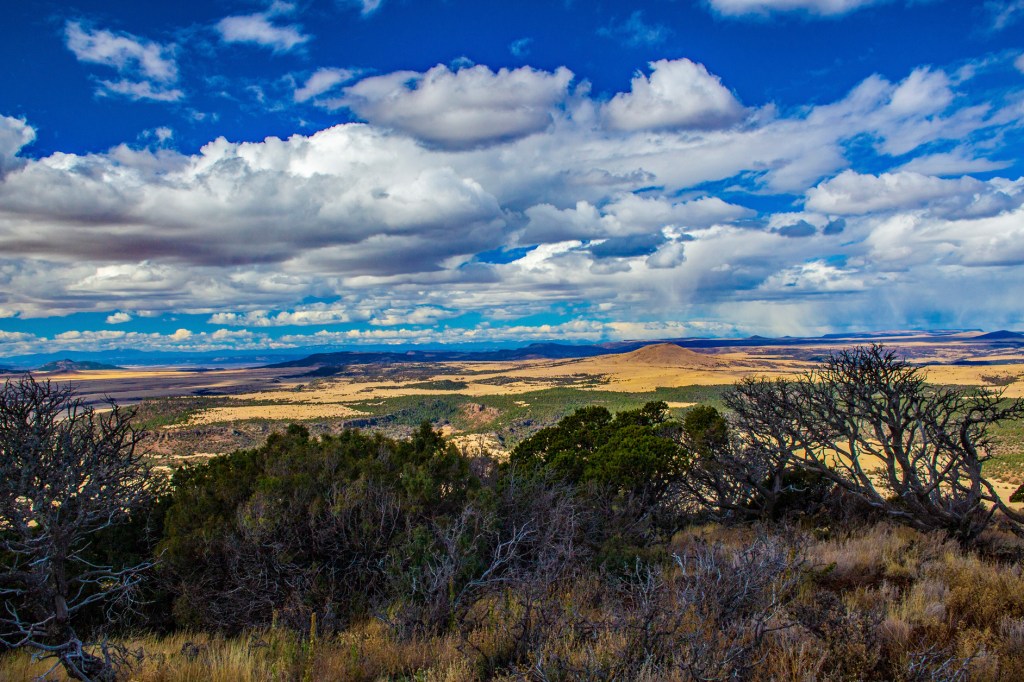
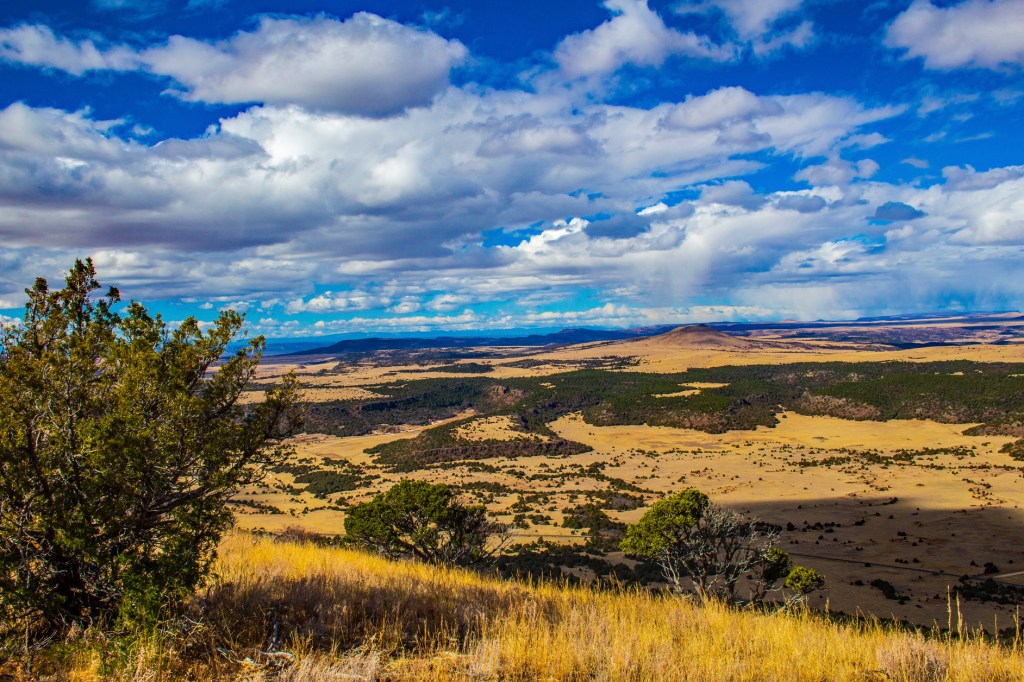
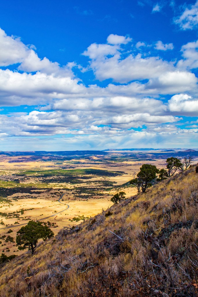
Well after breakfast we headed east to the Capulin Volcano National Monument in northern New Mexico. After visiting the visitors’ center and a short drive to the observation deck, Barbara waited patiently in the truck while I hiked to the summit of the Capulin Volcano and all around the ridge of its cone. Capulin’s cone rises 1,300 feet above the surrounding plains and tops out at 8,182 feet above msl.
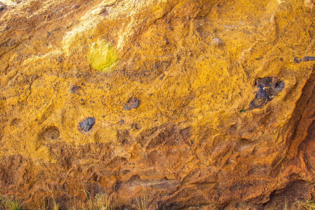
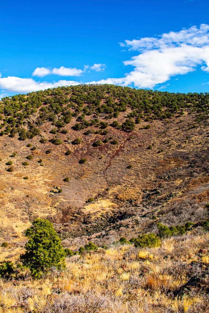
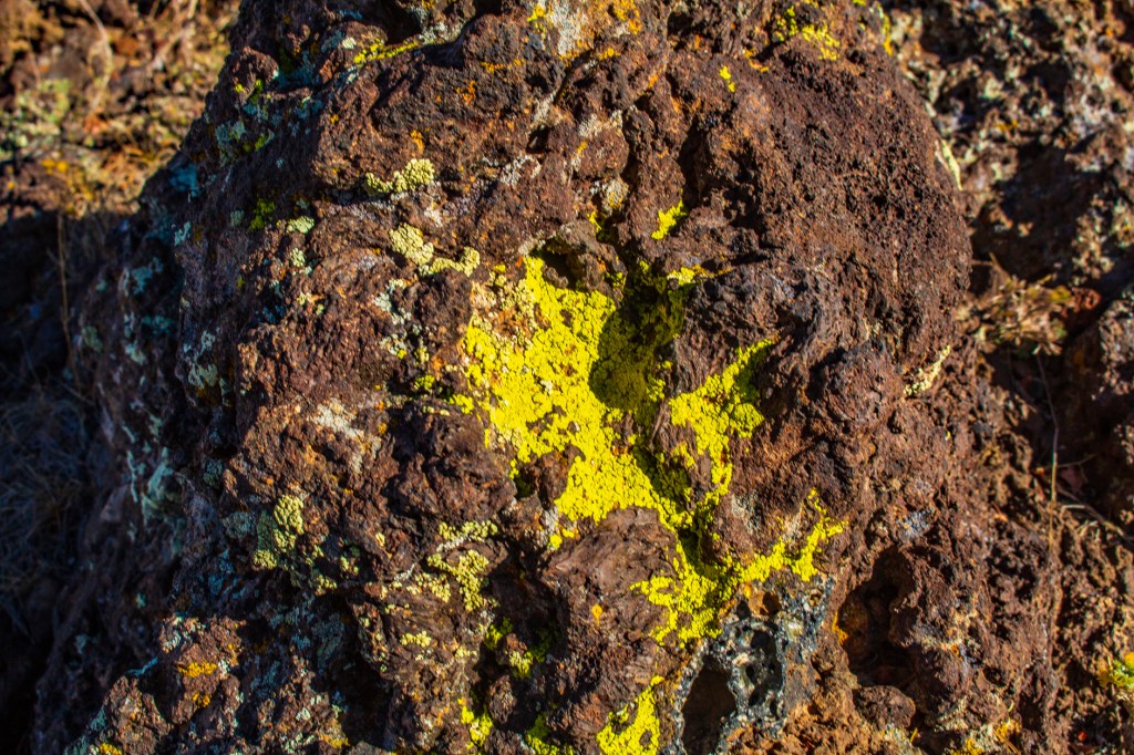
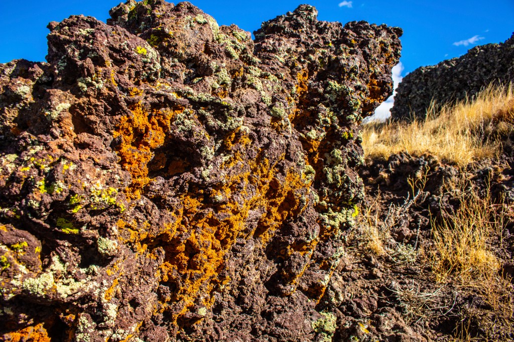
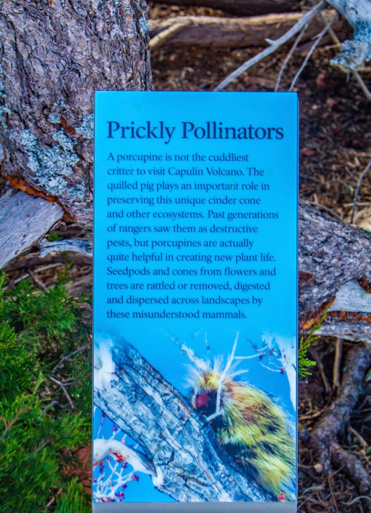
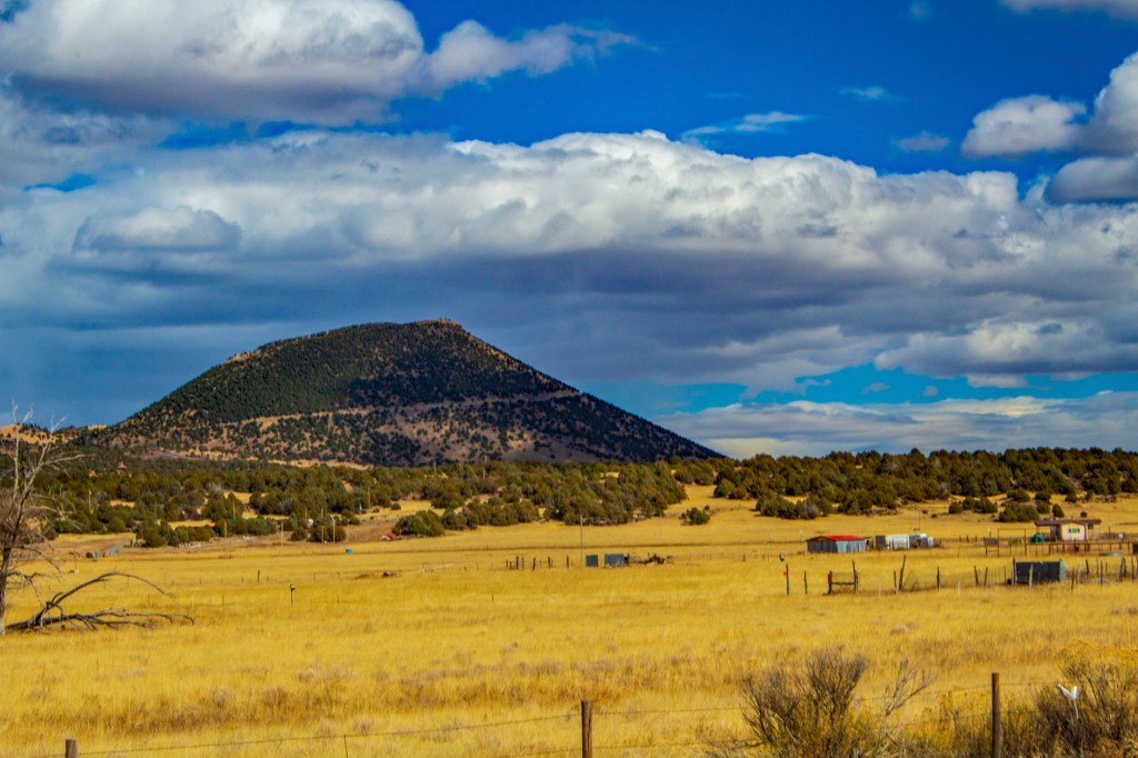
The Capulin Volcano is a cinder cone made up of unconsolidated volcanic rock. During the eruption, the Capulin Volcanoes magma contained a lot of trapped gases which is the reason for its explosive nature. Once the gas rich magma had been depleted the subsequent eruptions were nonexplosive, emanating from the base of the volcano. This is a common occurrence of cinder cones. There were four known lava flows emanating from the base of the Capulin Volcano. The Capulin Volcano is the center piece of the 8,000-square-mile Raton-Clayton Volcanic Field. The volcanism here began approximately 9 million years ago when crustal extension created cracks in the earth’s crust, which allowed the magma to rise to the surface. By comparison the Capulin Volcano is only 60,000 years old. In that 60,000 years weathering and breakdown of the rock by organisms like lichen have created enough soil for plant, and subsequently, animal life to thrive here. Take a look!
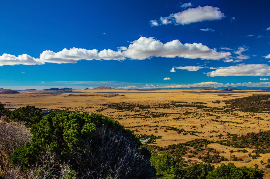
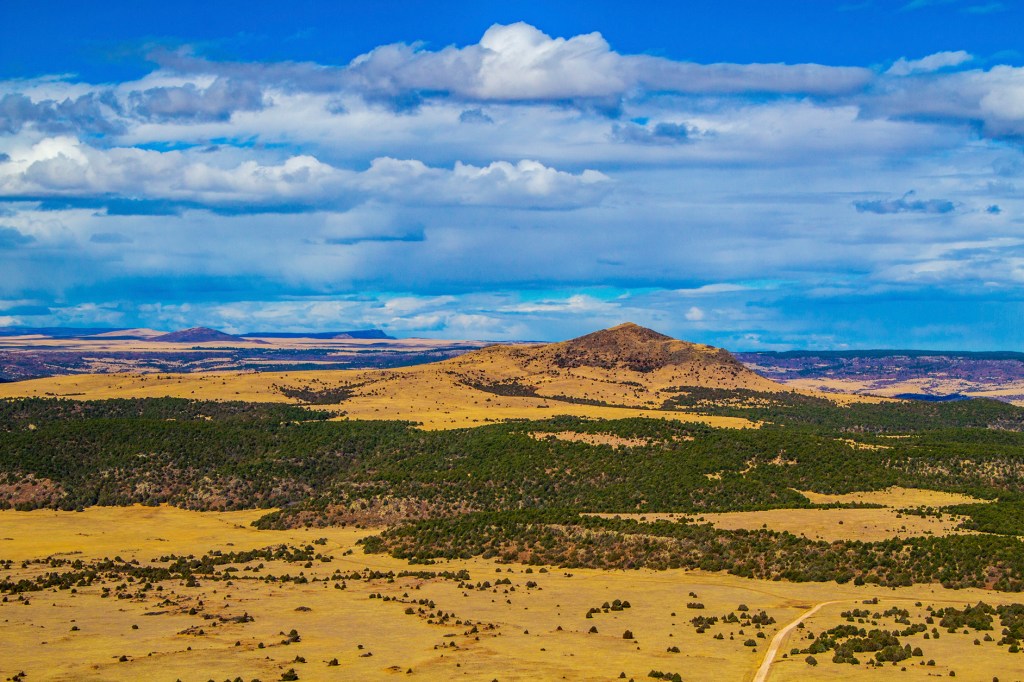
A cutout of the rock on the northeast side shows the unconsolidated rock, lapilli and volcanic tuff. Another cutout of the rock on the northeast side shows the unconsolidated rock, lapilli and volcanic tuff, with larger fragments of consolidated volcanic rock. Looking southwest.Looking northwest.Looking south.A view inside the crater.Lichen growing on the rock.More lichenThis is Sierra Grande, the largest volcanic vent in the volcanic field. Sierra Grande is a shield volcano. The big island in Hawaii is also a shield volcano. Shield volcanoes are not common on continents. Baby Capulin in the center of the photo is also a cinder cone.Looking north.This photos shows the slope of the northeast flank of the Capulin cinder cone. The Capulin cinder cone from three miles away.
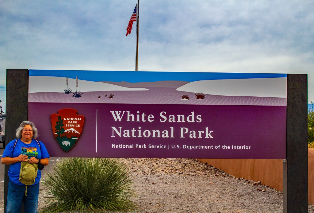
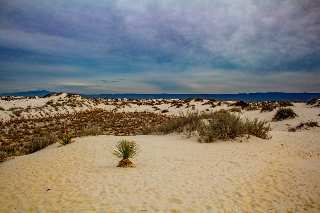
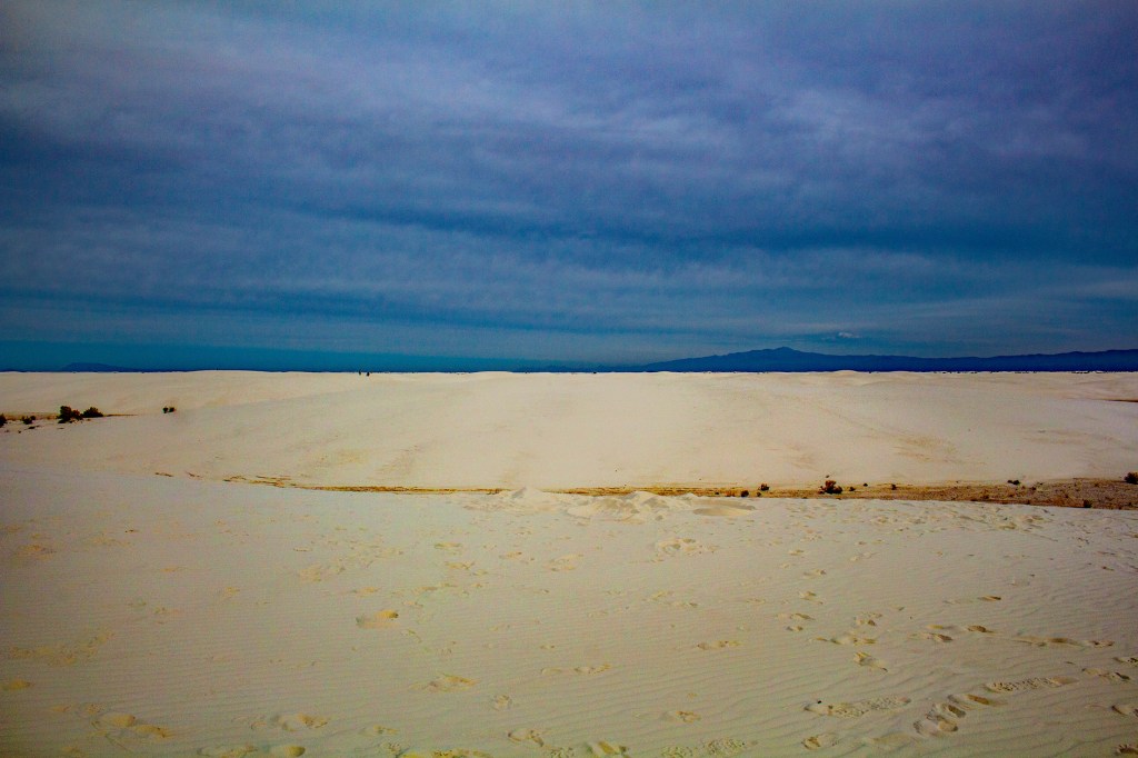
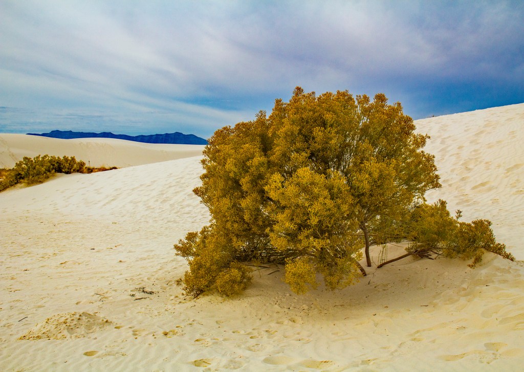
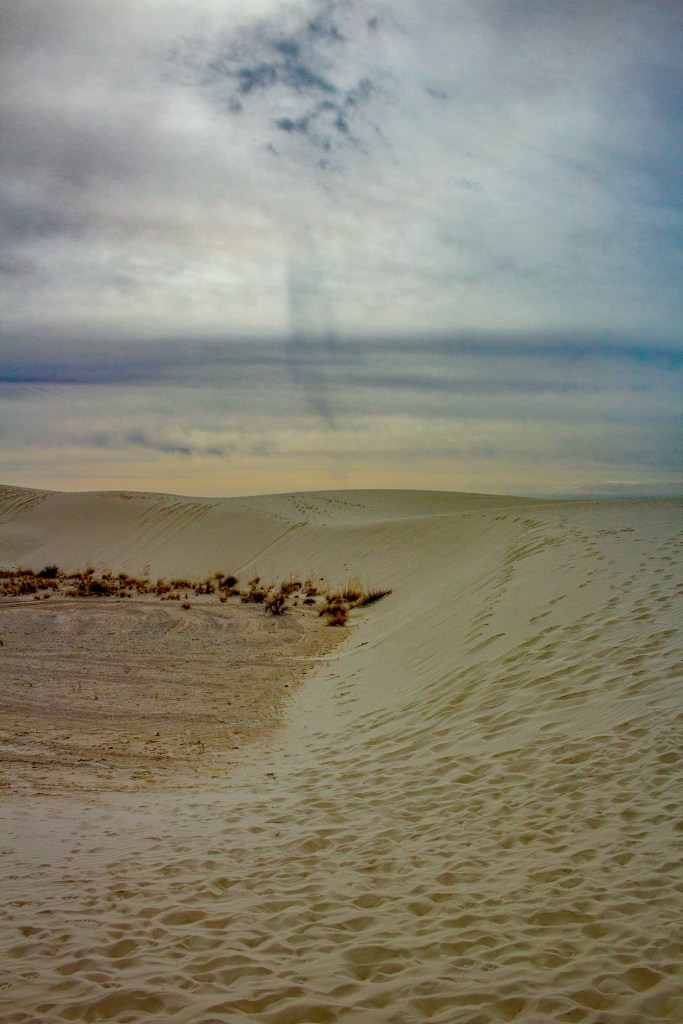
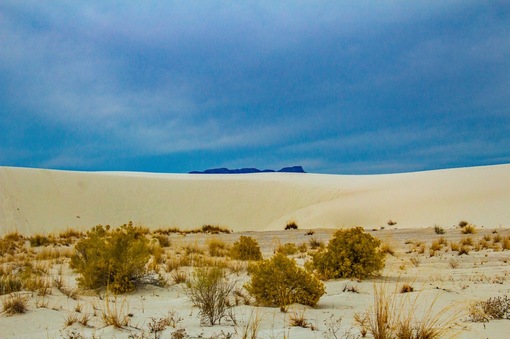
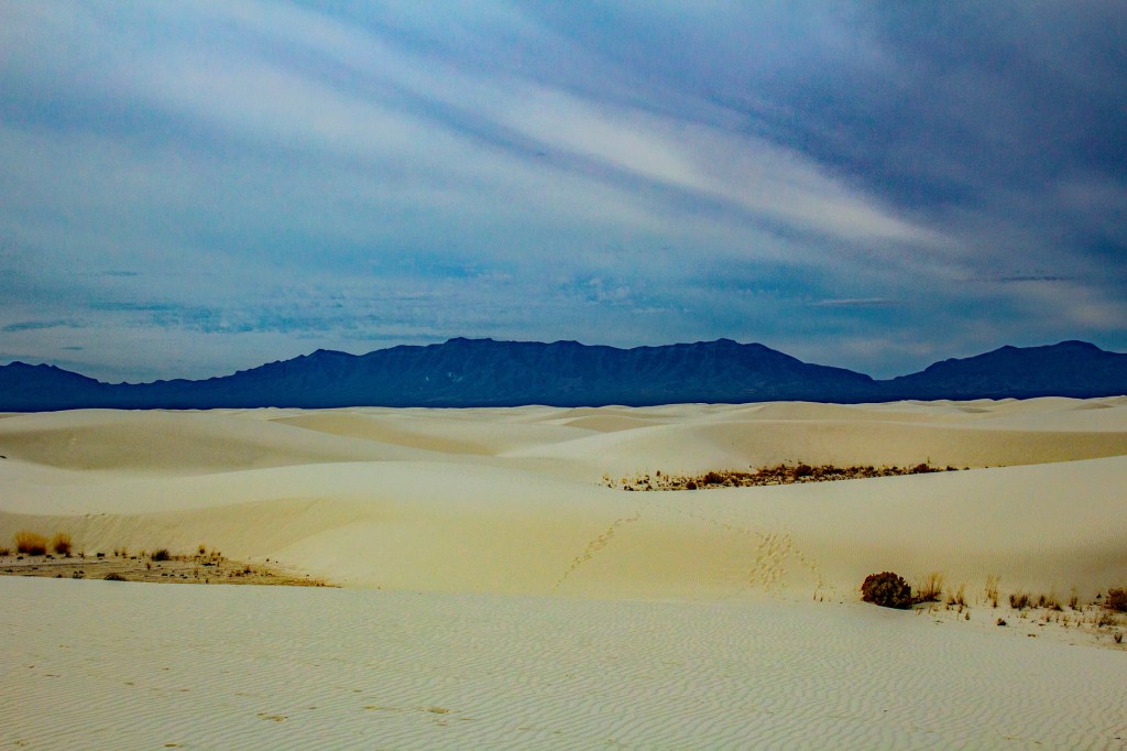
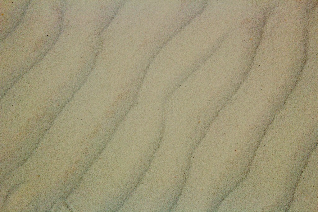
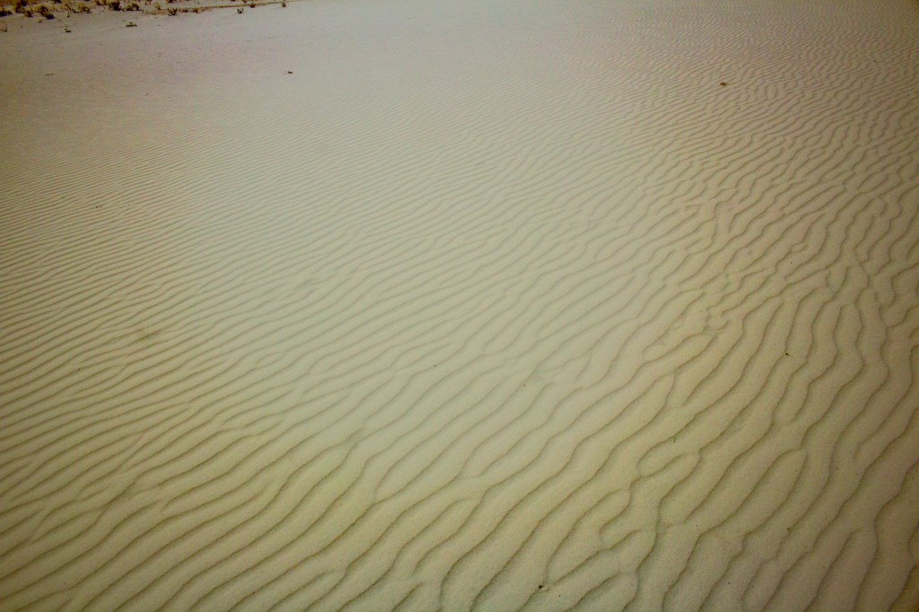
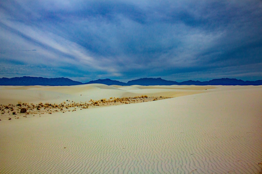
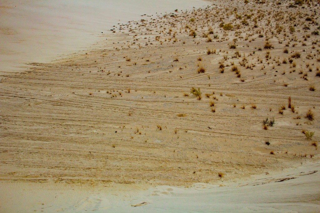
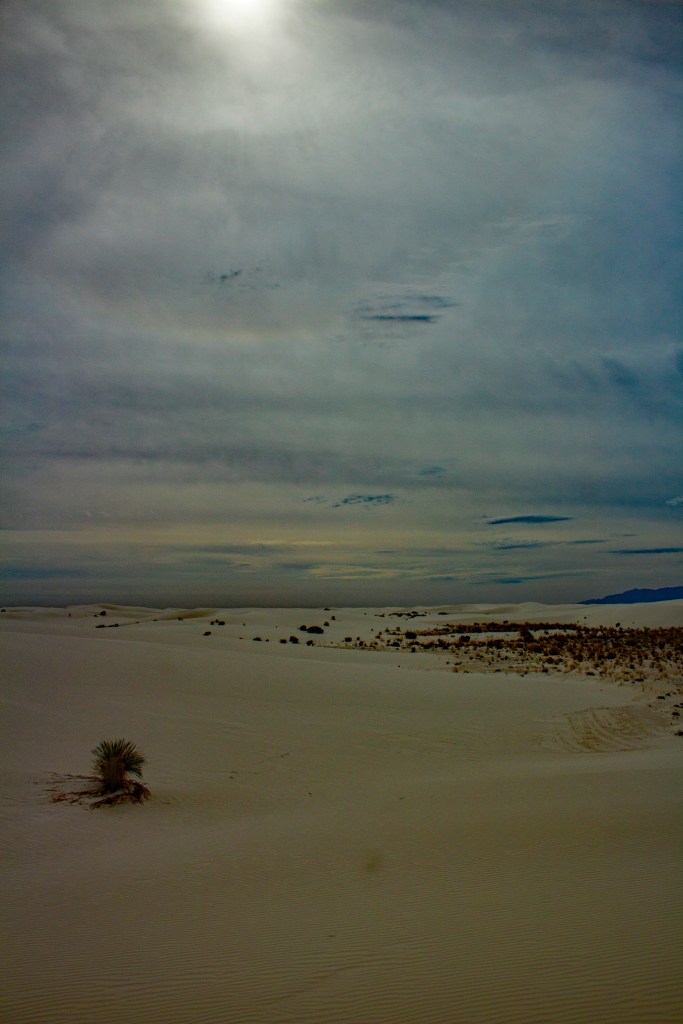
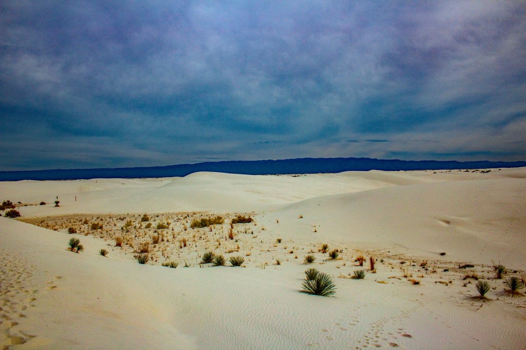
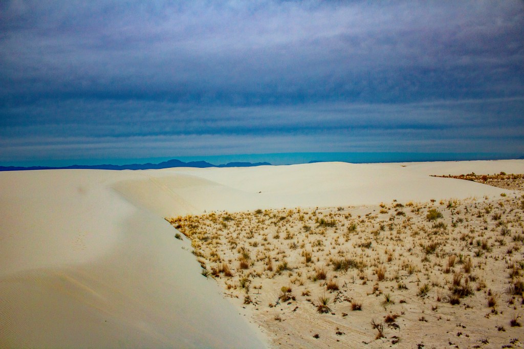
This morning Barbara and I traveled to the White Sands National Park. This park was created for the purpose of protecting 275 square miles of dunes made predominately of gypsum. On the Mohs hardness scale, which goes from 1, softest, to 10, hardest, gypsum is a 1. What makes these dunes different from other dunes is the gypsum. Most dunes are made up of quartz sand where these dunes are made up of gypsum sand, and White Sands National Park is the largest collection of gypsum dunes anywhere on earth. In fact, this collection of dunes is visible from the International Space Station.
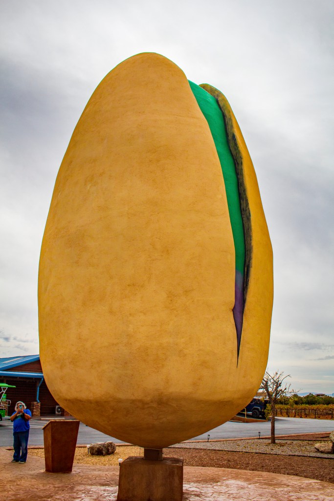
After we left the national park we drove to McGinn’s Pistachio World to see the worlds largest pistachio.
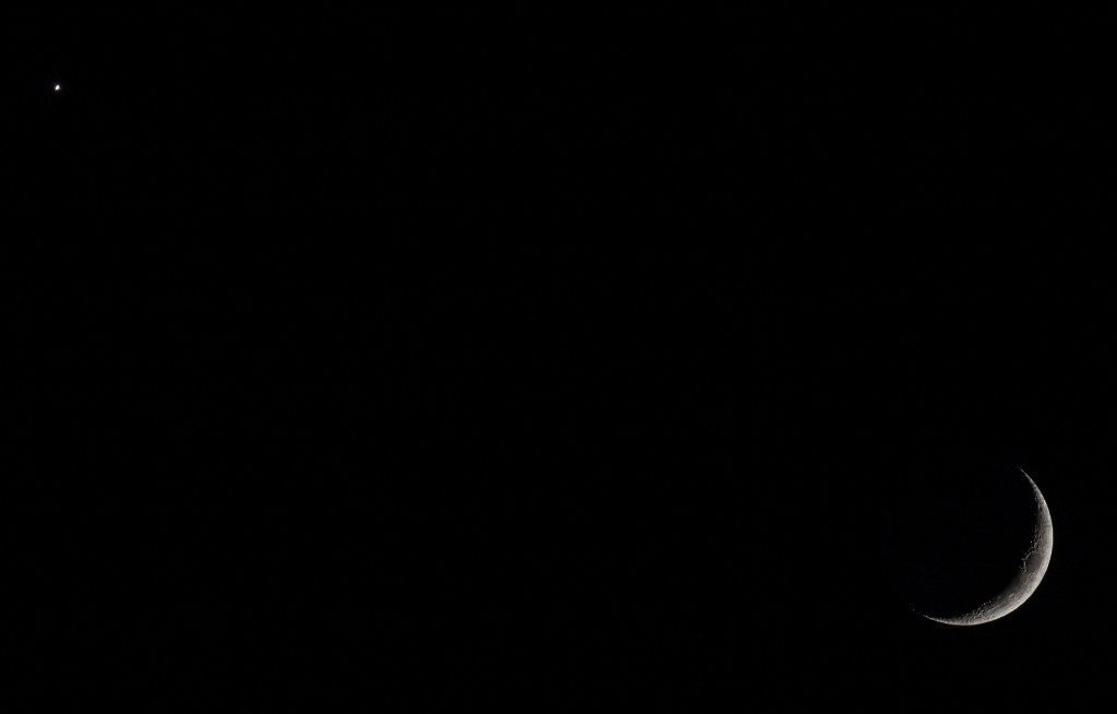
Last evening after we arrived in the town of Alamogordo, New Mexico, where we are currently staying, I stepped outside to view the moon and Venus low in the western sky. It was a great view. I tried taking photos of the two, but they just don’t do it justice. I did get a nice shot of the waxing crescent moon.
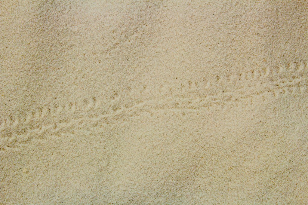
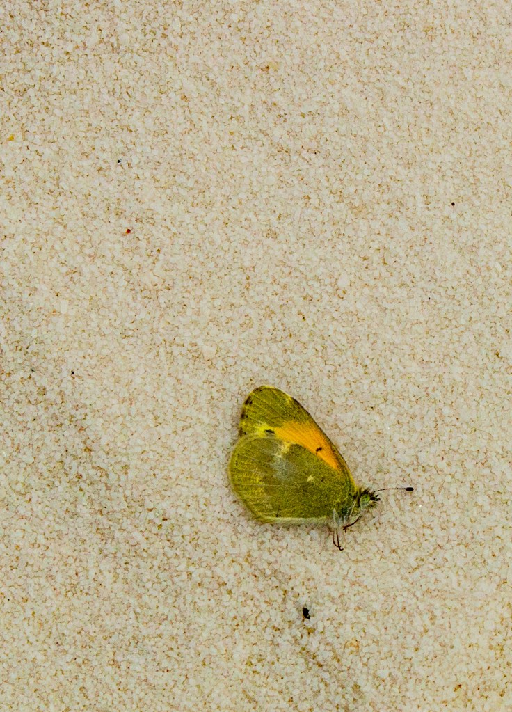
Critter tracks. If you look closely you can see ripple marks running top to bottom. This is a photo of ripple marks in the sand. These are created by the wind blowing across the surface of the sand. In this photo the wind was blowing from the upper left corner of the photo to the lower right corner. This photo shows the same thing on a larger scale.A moth lying in the sand for scale. Here you can see the size of the sand grains. This is an example of cross-bedding. As the direction of the wind changes so does the angle of the cross bed. Waxing crescent moon. Venus in the upper left corner and the moon in the lower right corner.Worlds largest pistachio.
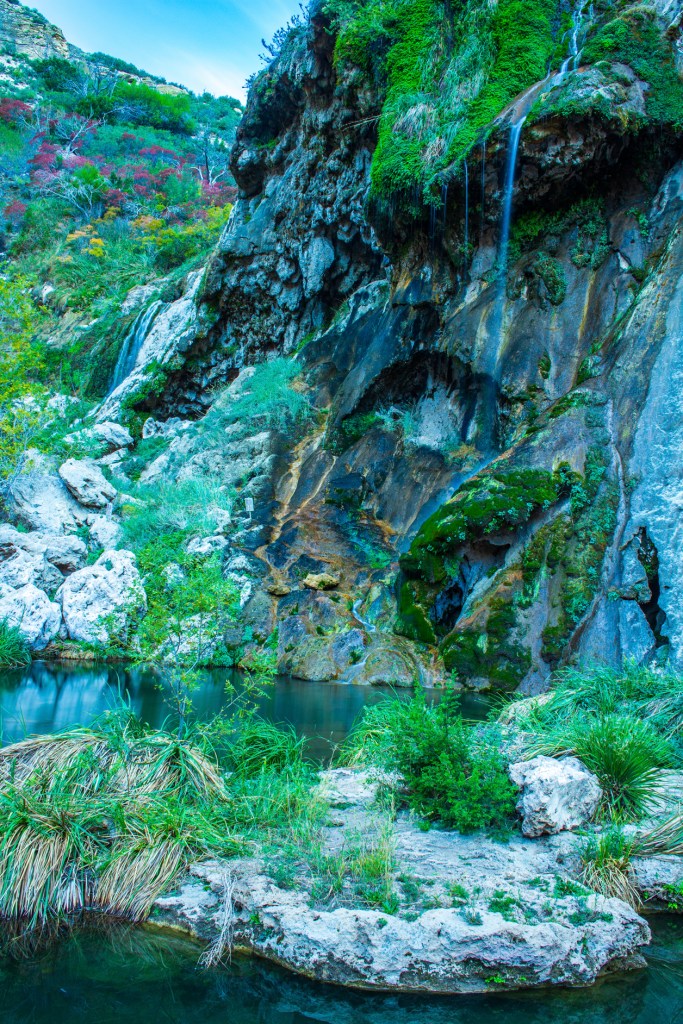
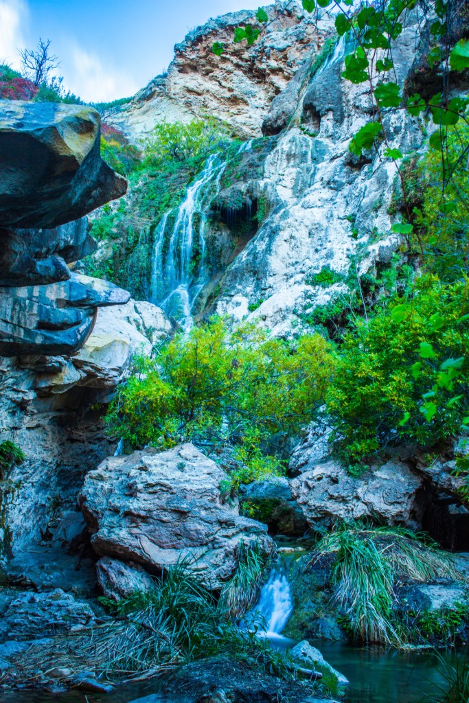
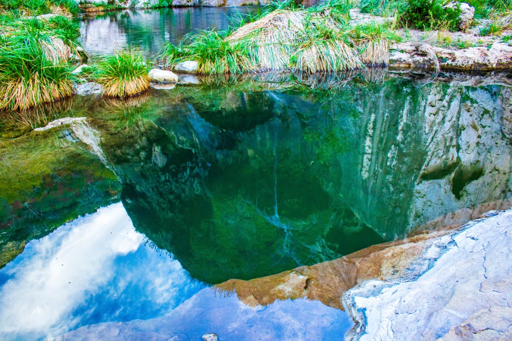
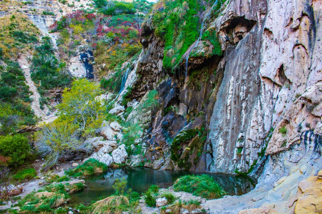
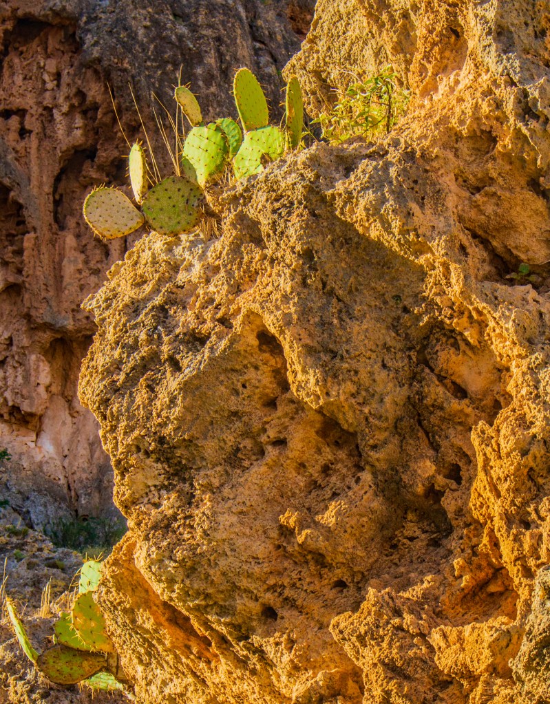
This morning Barbara and I got up at 6:30am to go to see Sitting Bull Falls before the crowds arrived. We were in luck as we only encountered one other visitor while we were there. As it turned out, we arrived at the same time as the ranger who opened the gate. On the drive there Barbara and I were wondering if there was going to be any water when we arrived. The first thing we asked the ranger was, “is there any water for the falls?” He said there was, so our trip wasn’t for not. It’s amazing how things in the desert change, as far as vegetation goes, when there is water present. Take a look!
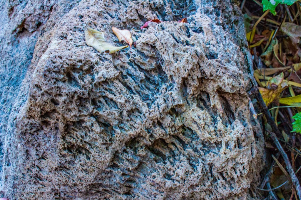
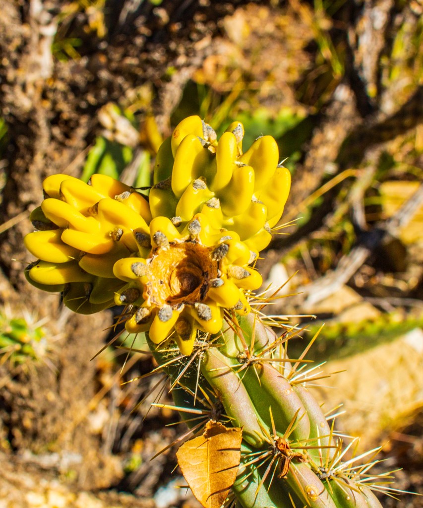
The park hosts look a little parched. This carbonate rock (limestone) use to be part of a coral reef.Reflection of the falls in a pool below. These Prickly Pare Cactus seem to be able to grow anywhere.
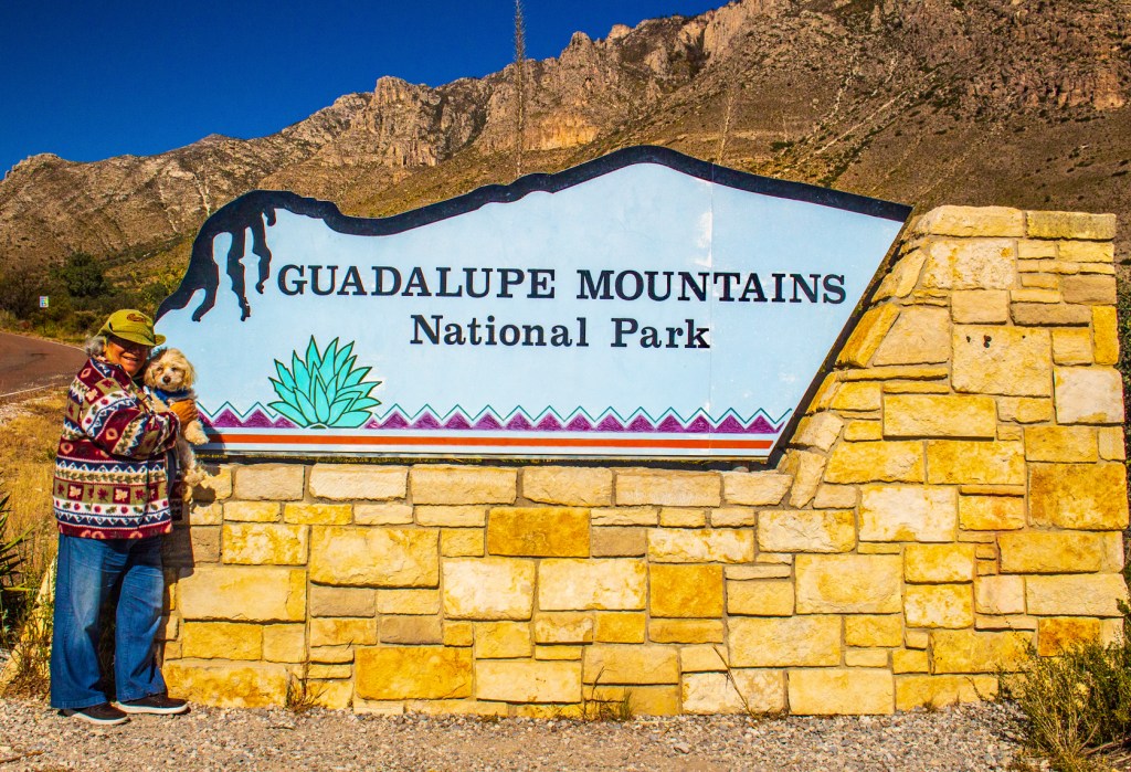
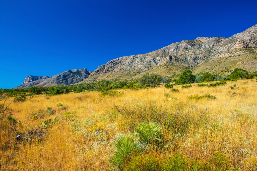
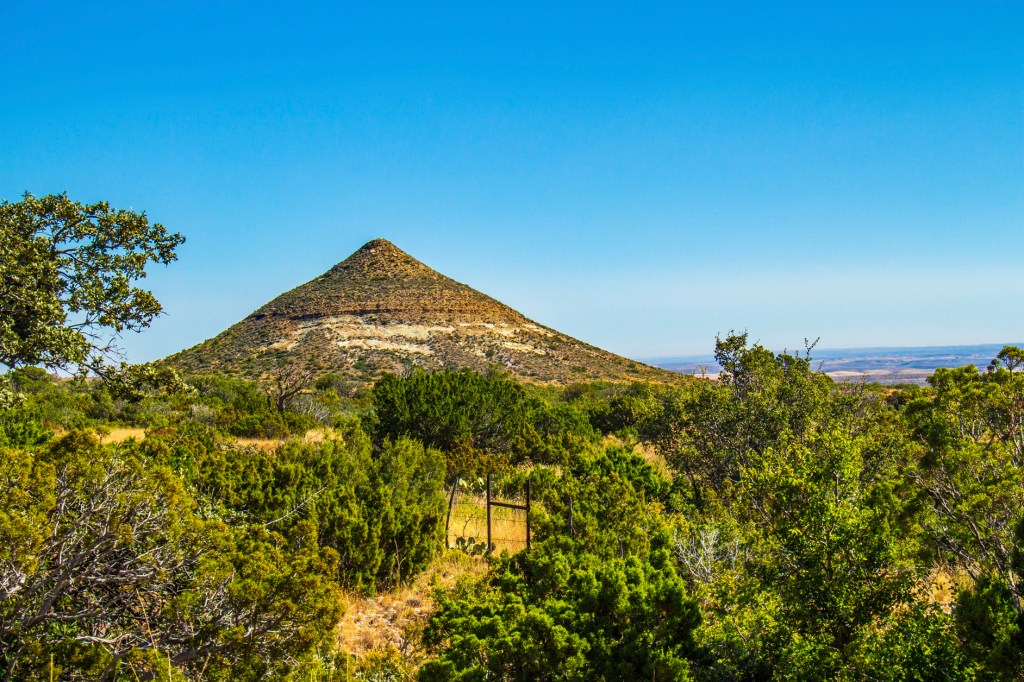
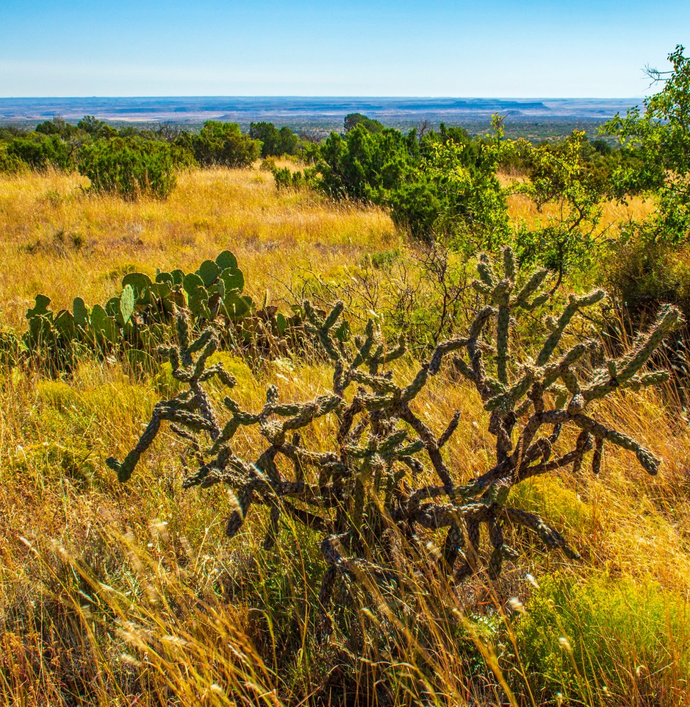
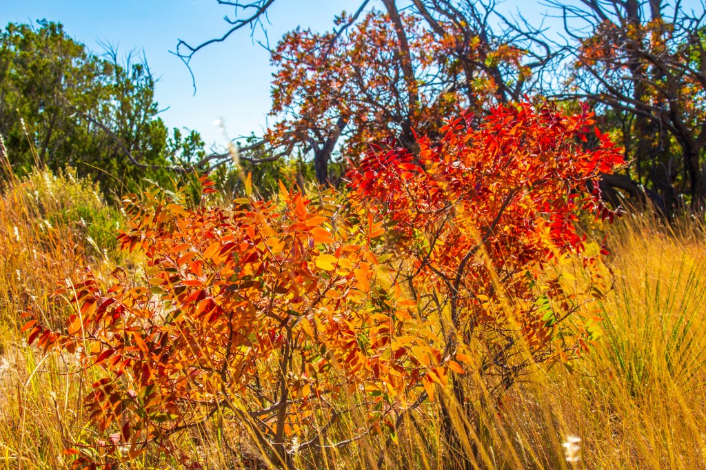
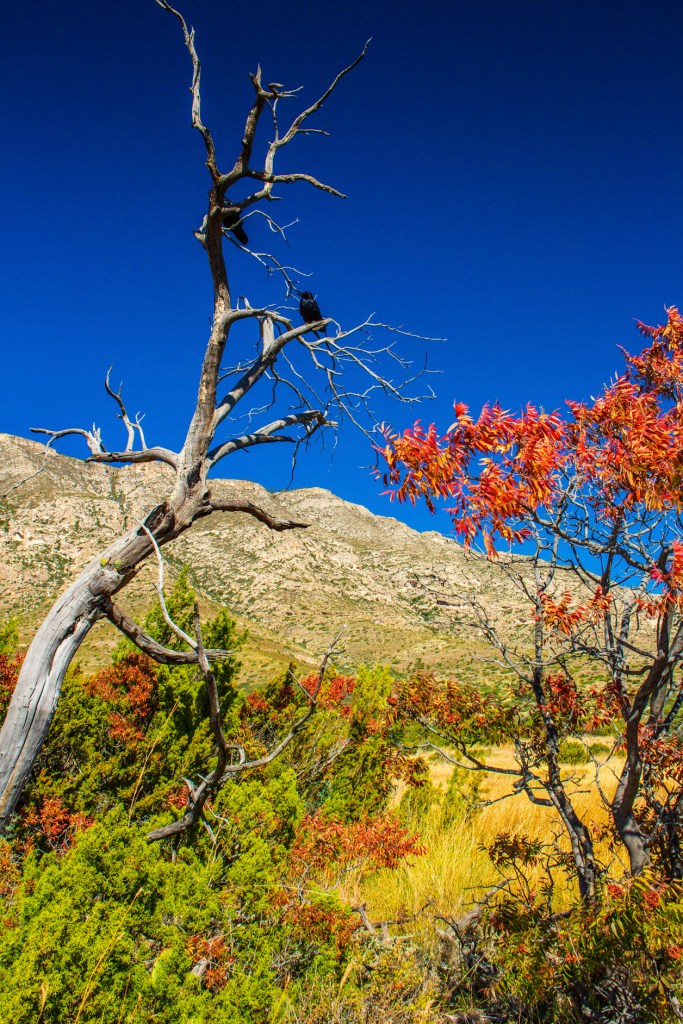
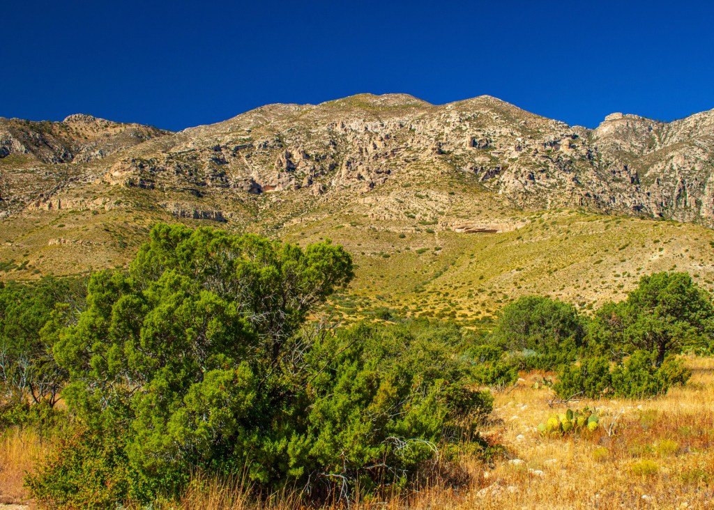
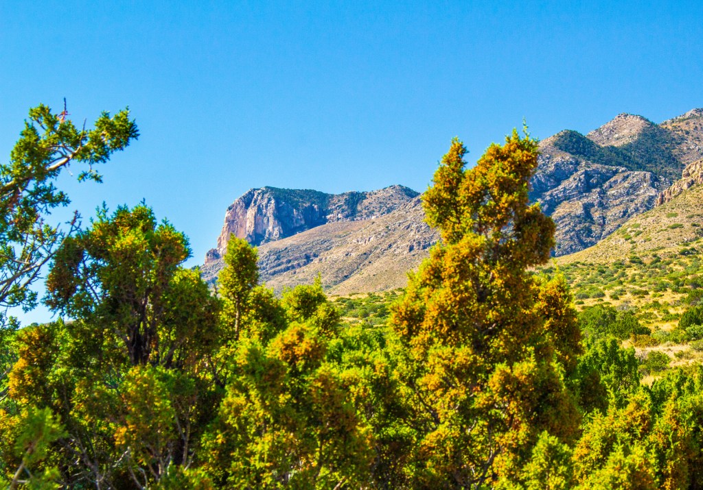
Today Barbara, Hopper and I traveled back to Texas to visit the Guadalupe Mountains National Park. The Guadalupe Mountains are home to the four highest peaks in the state of Texas. In addition, these mountains contain one of the best examples of a marine fossil reef. Geologists come from all over the world to marvel at this extra-ordinary phenomenon that formed, during the Permian period, approximately 265 million years ago. The reason that this area is preserved as a national park was to preserve this amazing fossil reef.
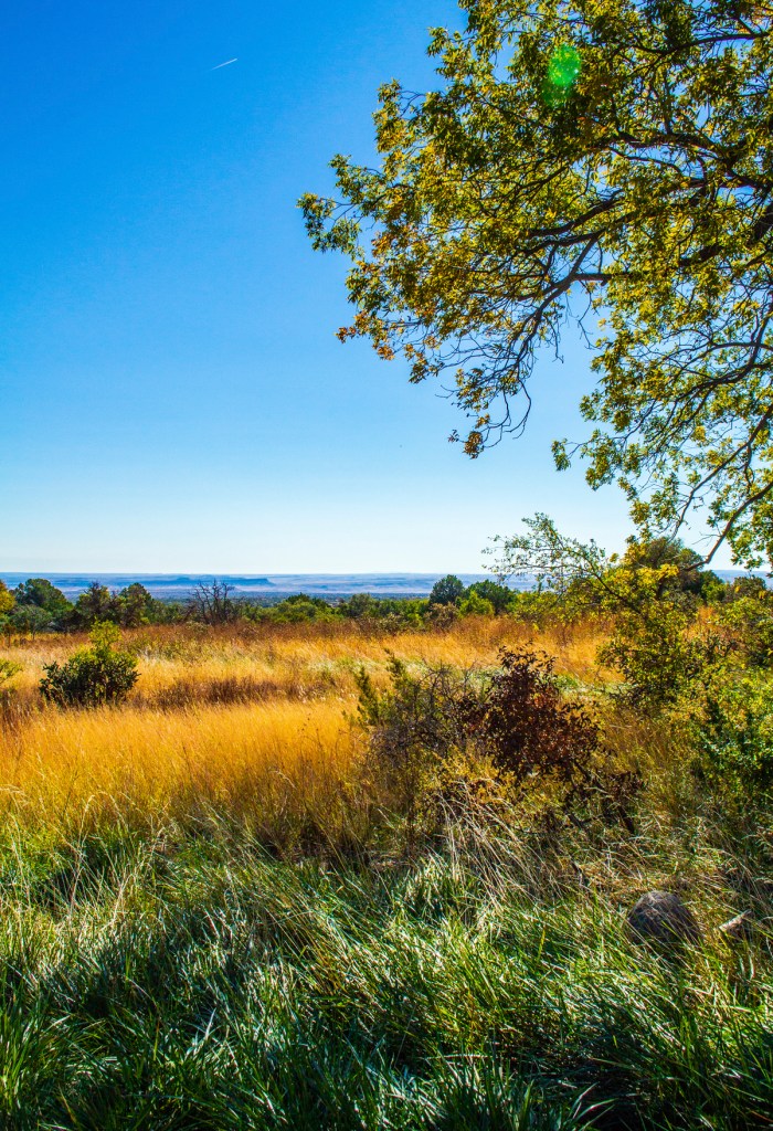
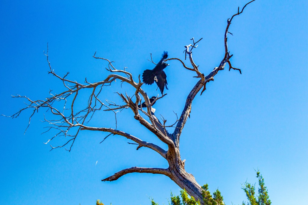
Barbara, Hopper and I visited the visitors center and then proceeded to take a short hike through this quiet, rugged mountain/desert landscape. Hopper enjoyed the hike from the comfort of his backpack on my back. Spoiled dog! According to the brochure that we were provided, there are a lot of wild animals that call this park home. The only ones we saw during our hike were two ravens watching over us from the branches of a dead tree. As far as national parks go there isn’t much here, but it does have a rugged beauty that I hope I captured in my photos.
Hunter Peak at 8,368 feet msl.The Guadalupe Mountains.Guadalupe Peak. The highest point in Texas at 8,751 feet msl.Hunter Peak at 8,368 feet msl.Guadalupe Peak.
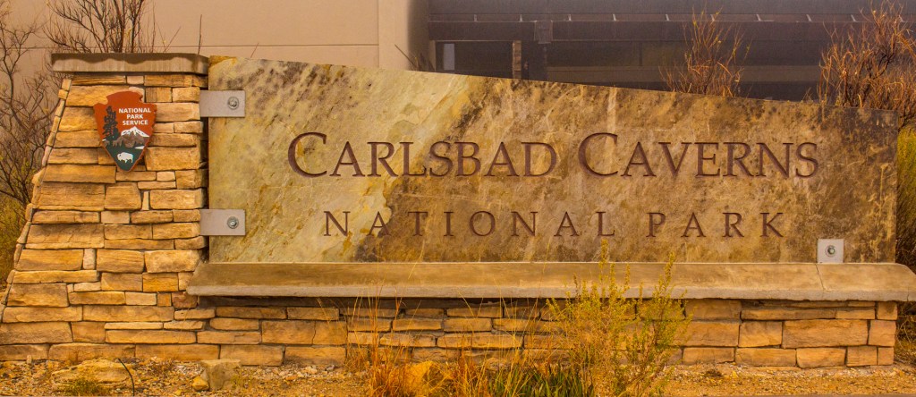
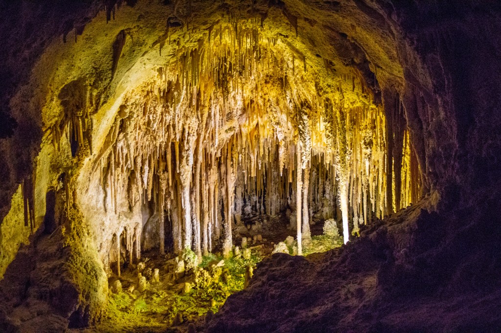
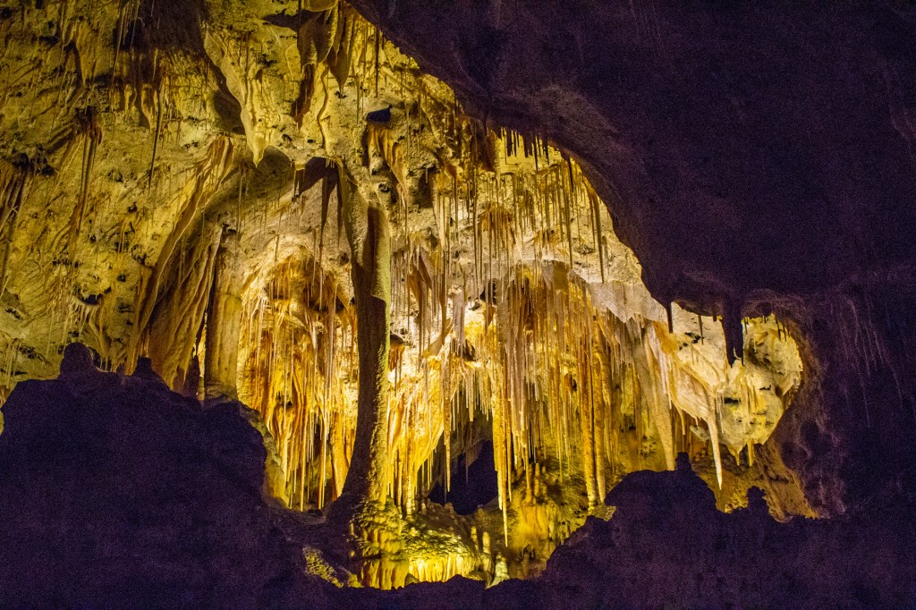
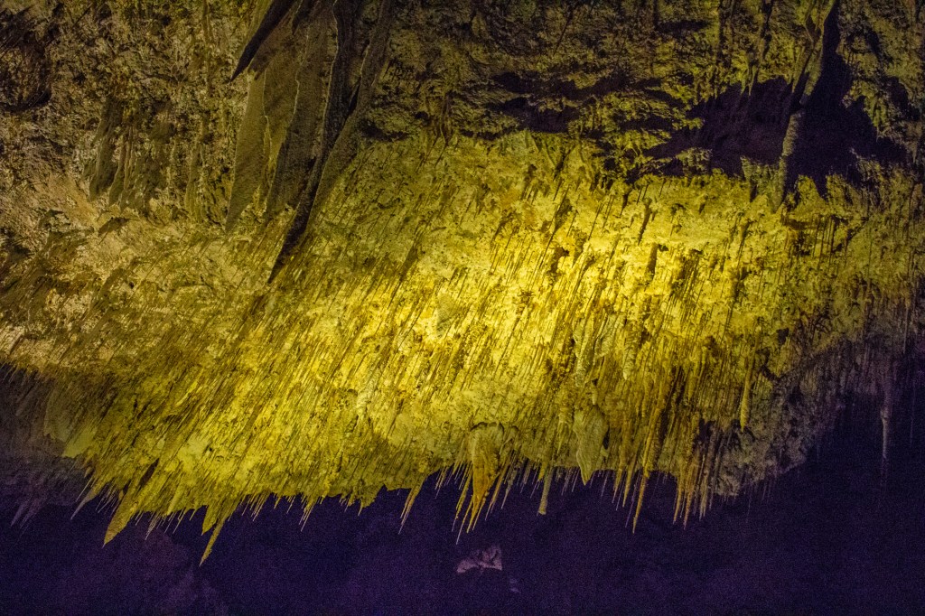
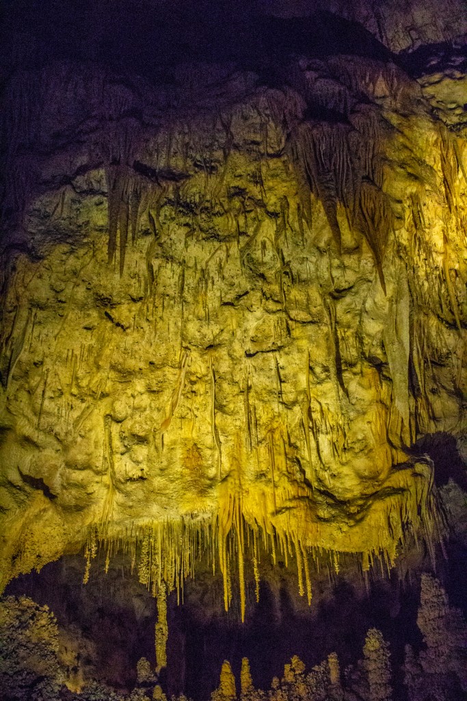
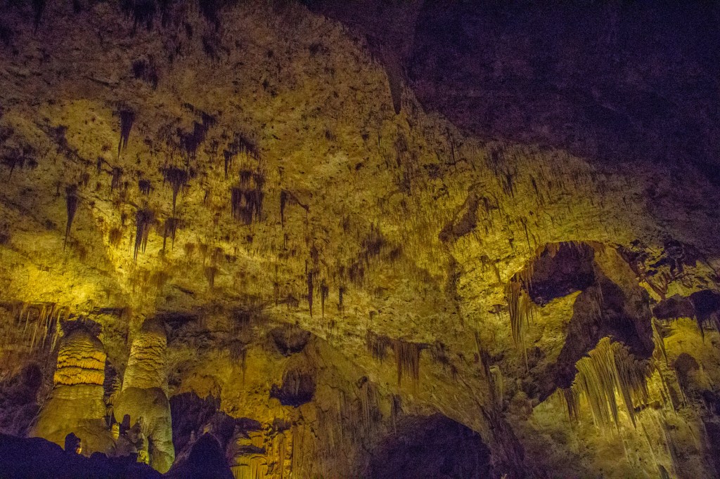
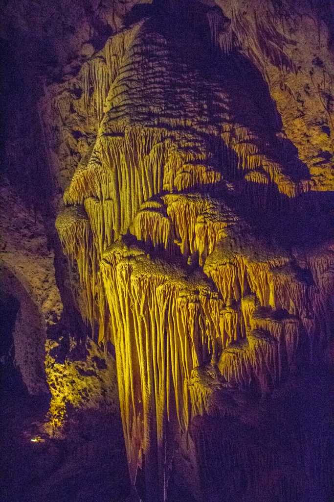
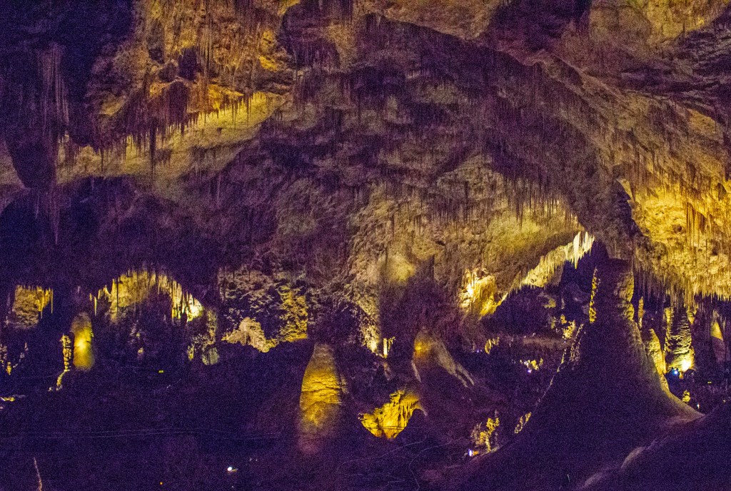
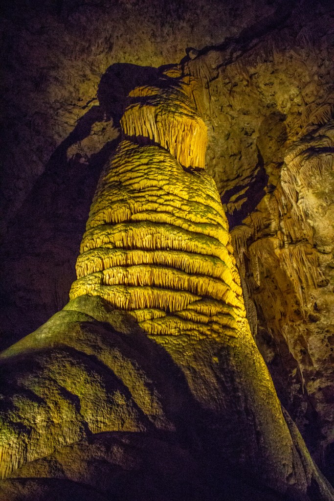
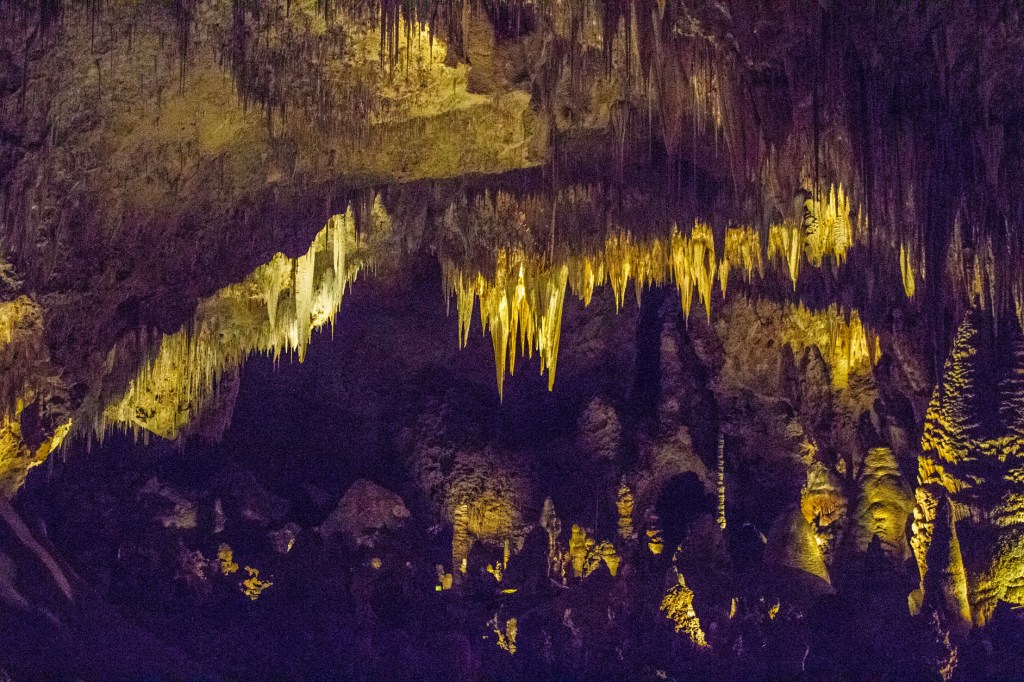
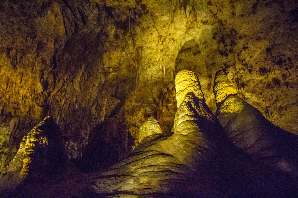
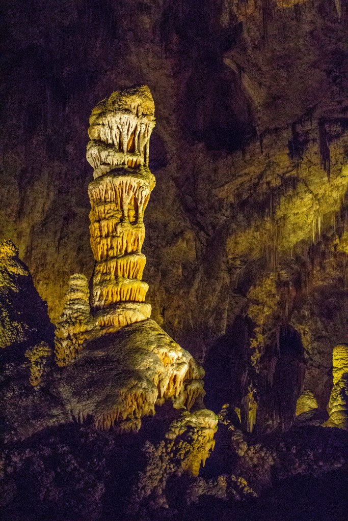
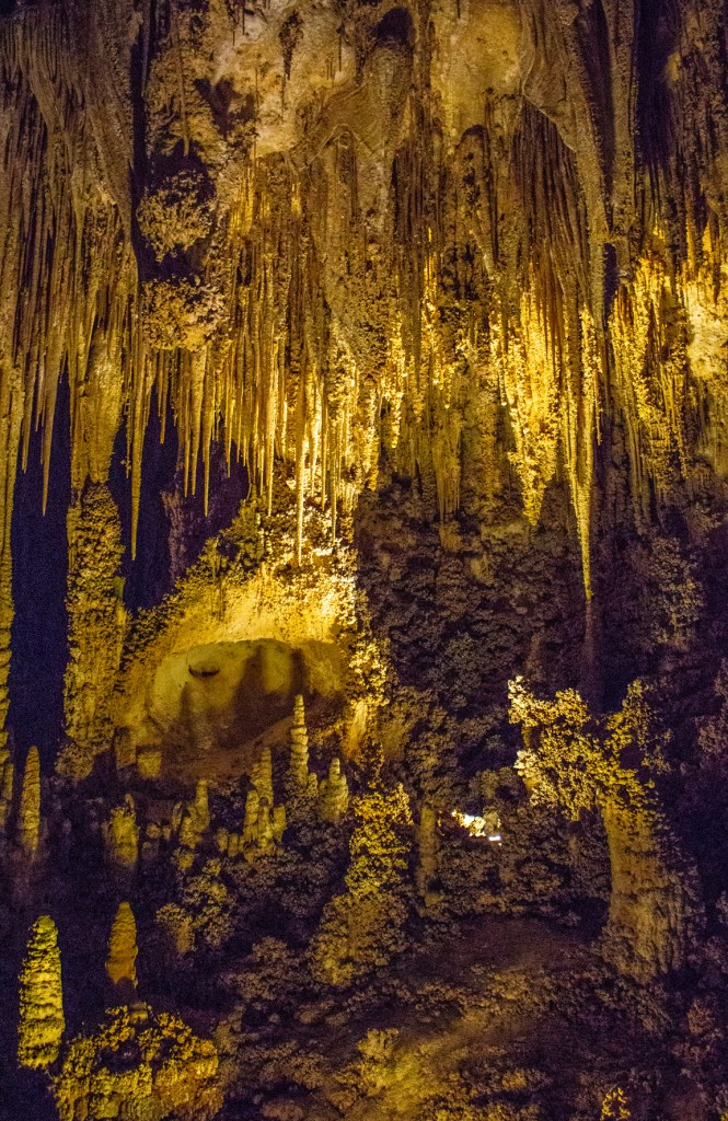
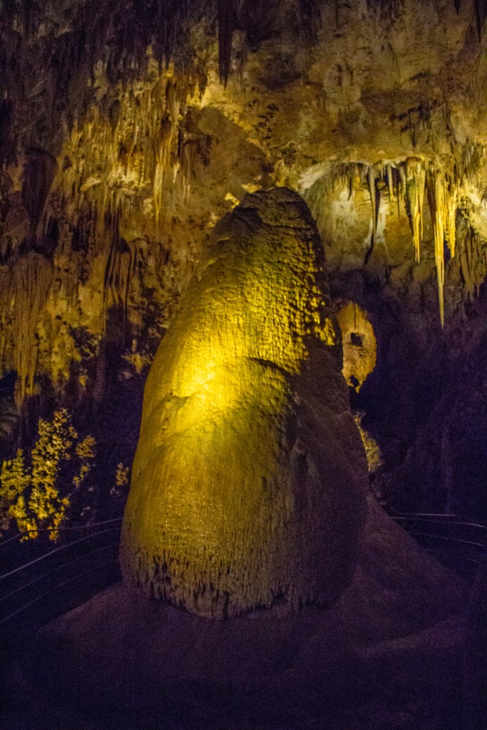
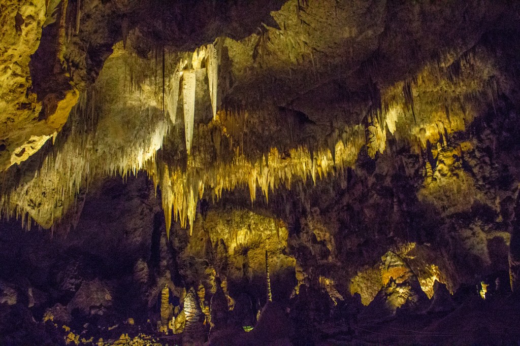
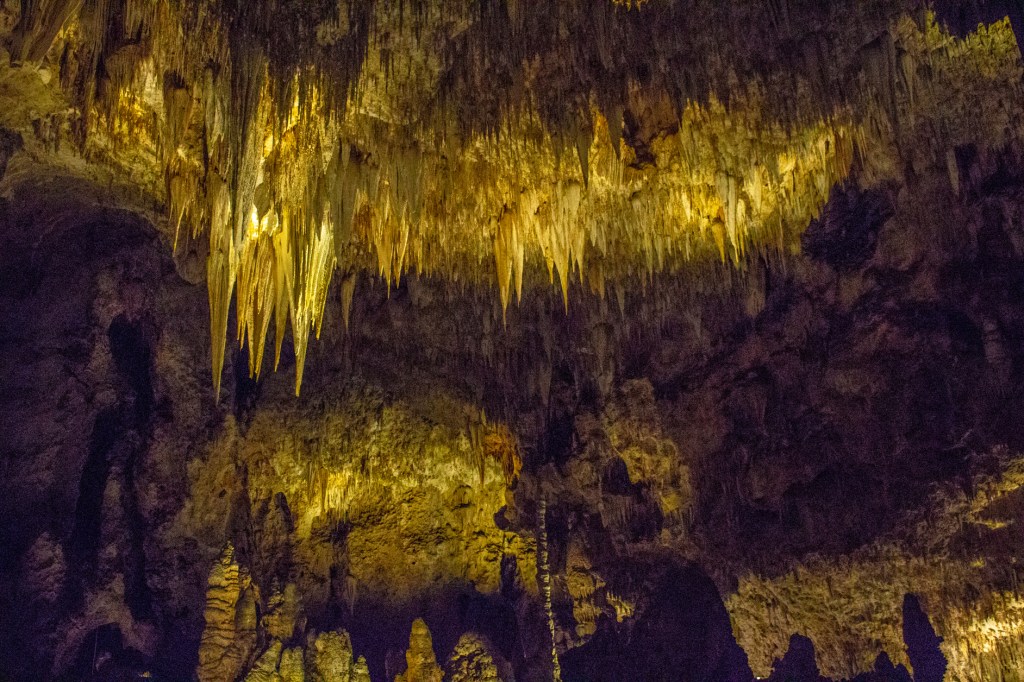
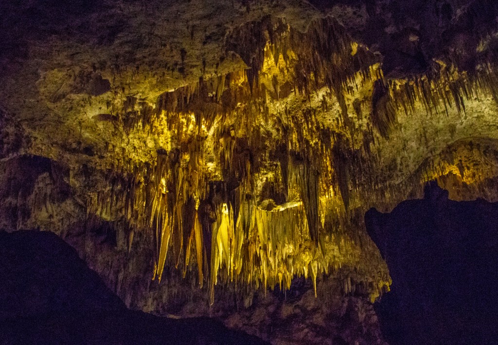
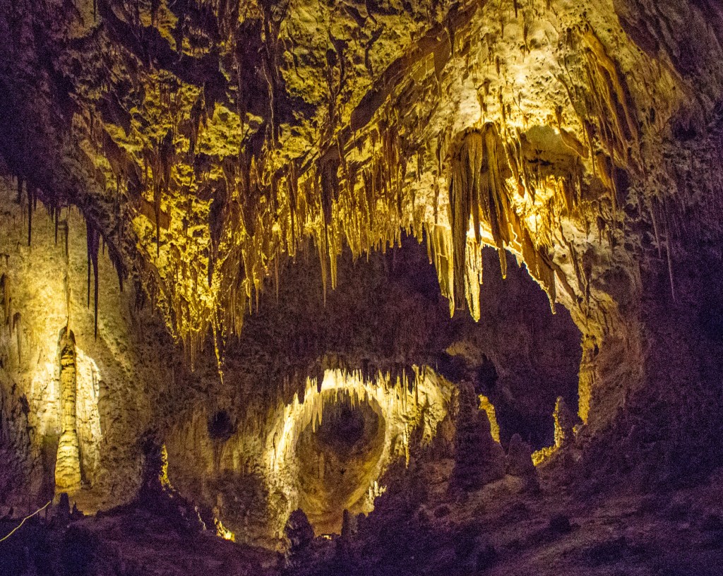
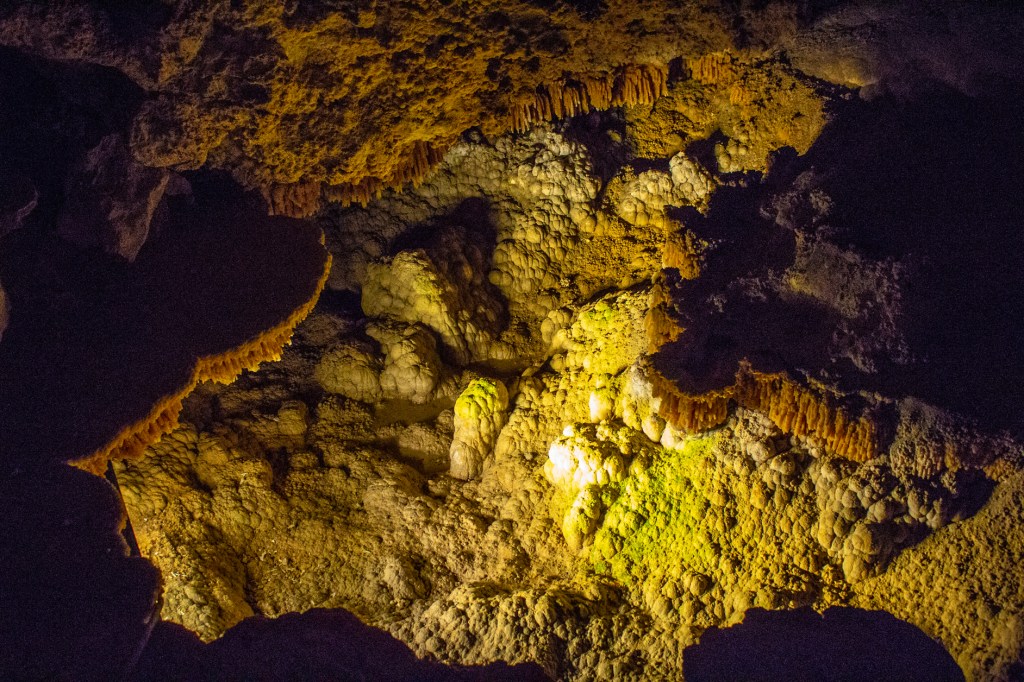
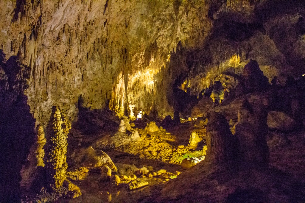
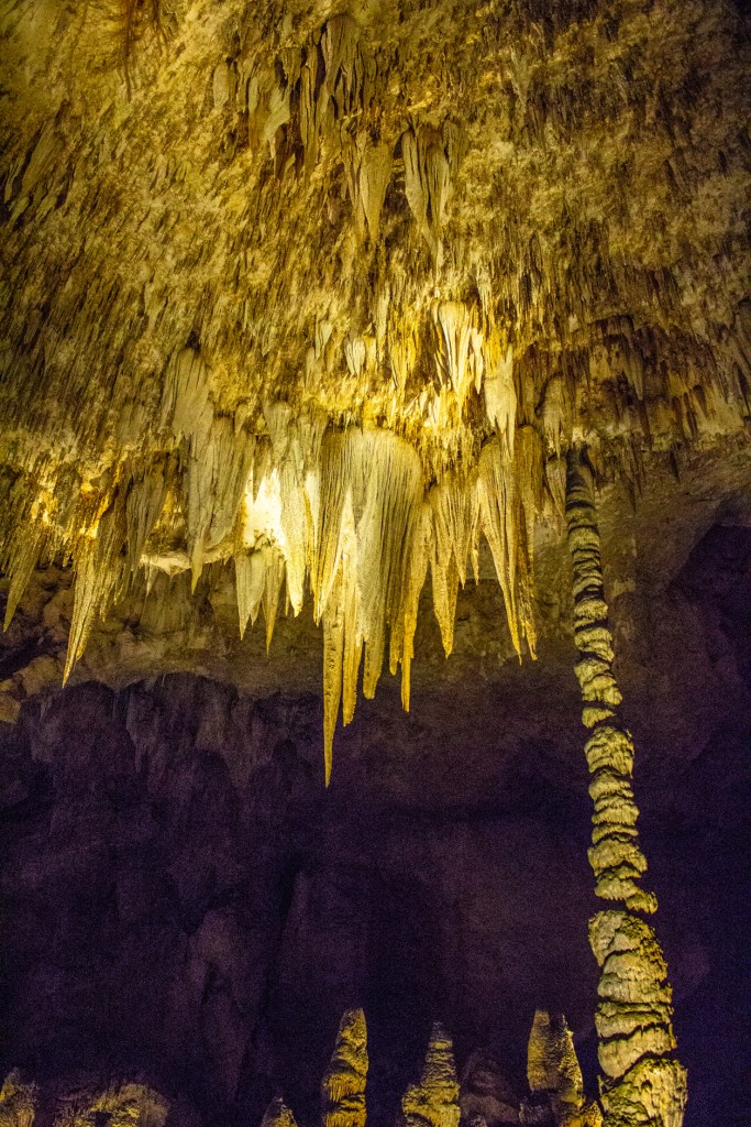
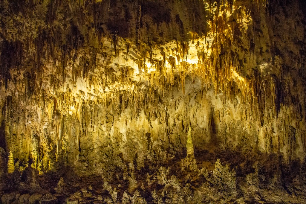
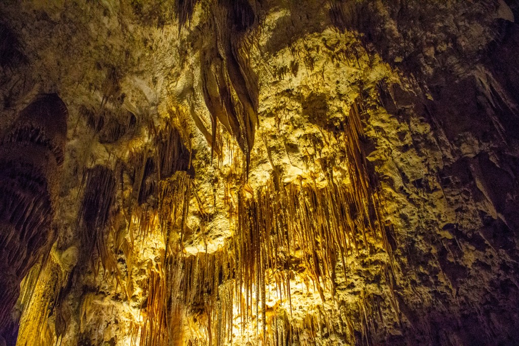
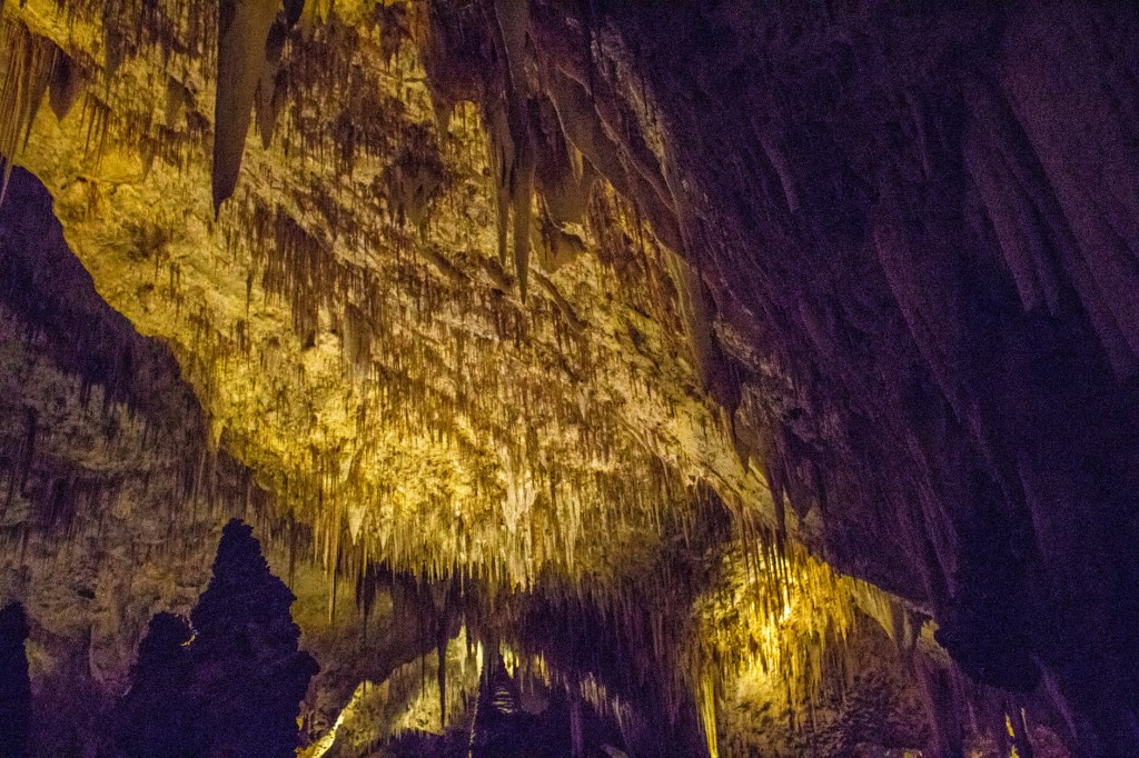
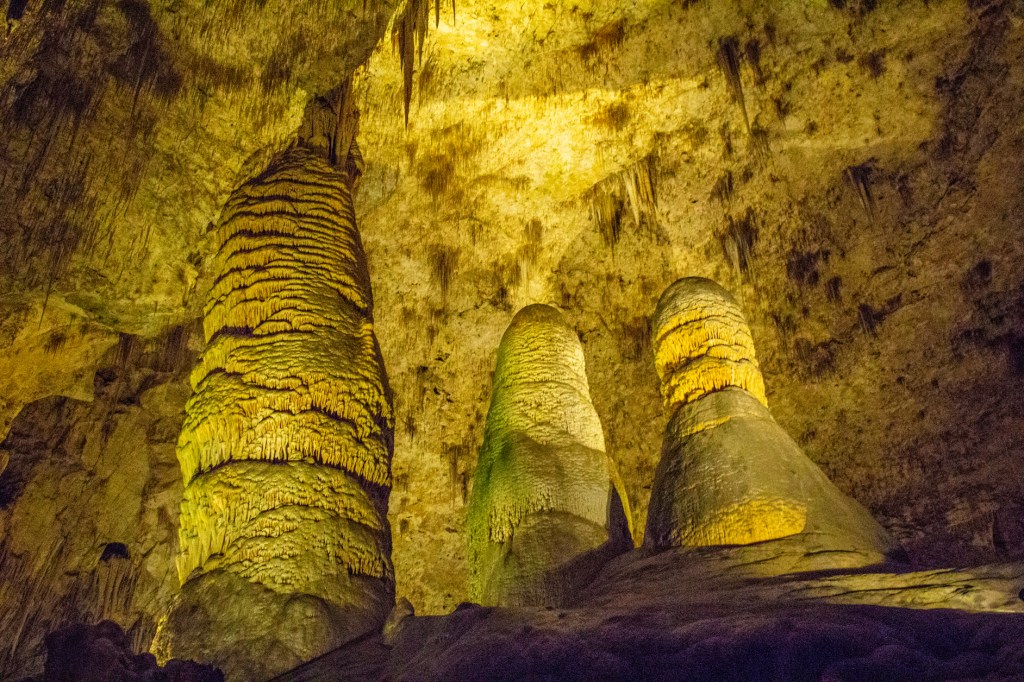
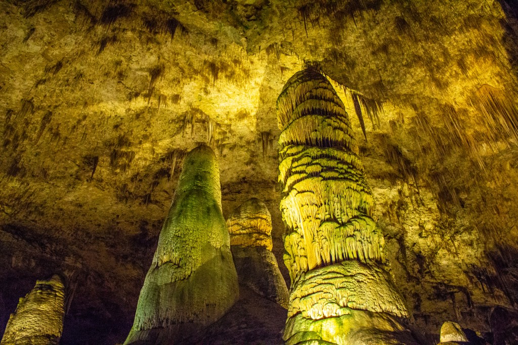
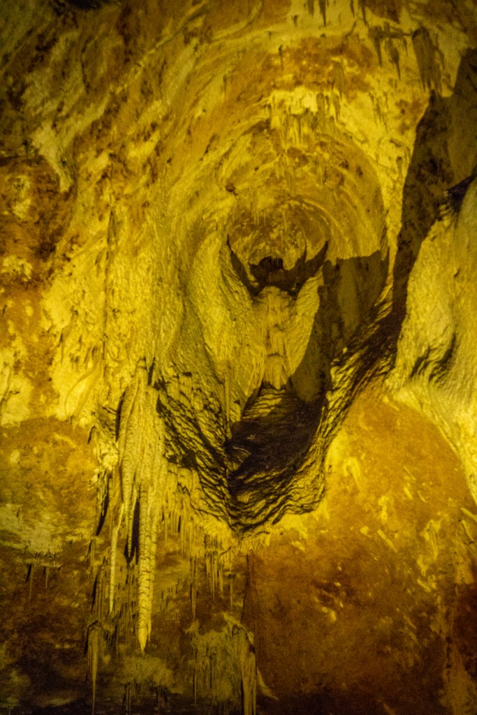
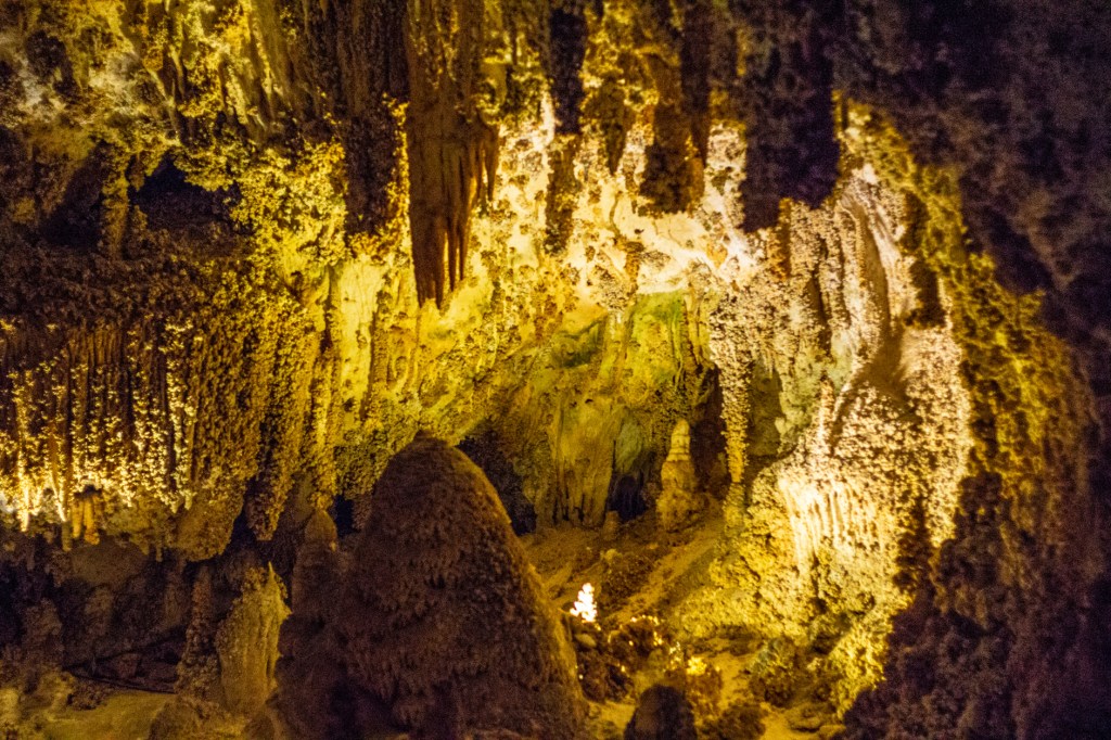
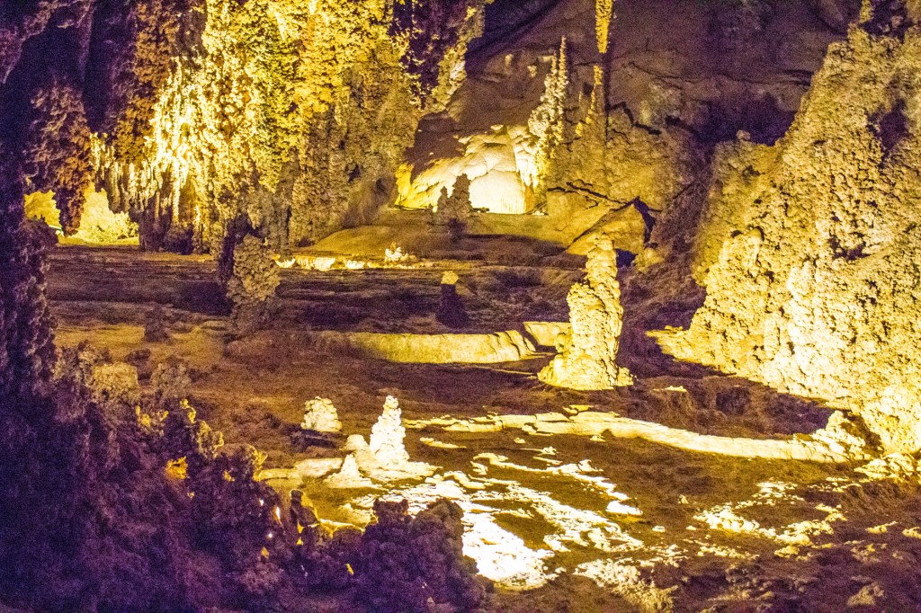
Yesterday Barbara and I explored Carlsbad Caverns National Park. We took the self guided tour through what is known as the Big Room. This is supposed to be a 1.5 hour stroll through the largest open area in the cave. However, it took us 2.5 hours to complete our tour. Honestly, I could have spent the entire day in the cave exploring, but I had to get Barbara out of there because after about an hour she started hallucinating. She started seeing things like dragons and Disney characters in the rock formations.
The geologic story of Carlsbad Caverns began 265 million years ago when a shallow sea covered this area. What became Carlsbad Caverns was then a 400-mile-long, horseshoe shaped, reef composed of mostly algae and sponges. Several million years later tectonic forces lifted the reef out of the shallow sea that covered this area.
Around 15-20 million years ago tectonic forces started pulling the southwest portion of this country apart like that seen today in the state of Nevada called the Basin and Range geomorphic province. This tectonic activity created the faults which created the parallel mountains and valleys seen in today’s Guadalupe Mountains. Over time caves developed in the area of the shallow sea and reefs. Hydrogen sulfide gas, sulfuric acid, water, bacteria all worked together to form what today is known as Carlsbad Caverns. Carlsbad Caverns is not the only cave in the Guadalupe Mountains. There are hundreds of caves in the area, known and unknown.
Carlsbad Caverns is also a sanctuary for hundreds of thousands of Brazilian free-tailed bats. Not to worry though as they only come out at night and head outside to get their fill of insects. This time of year they are gone due to their annual migration to Mexico.
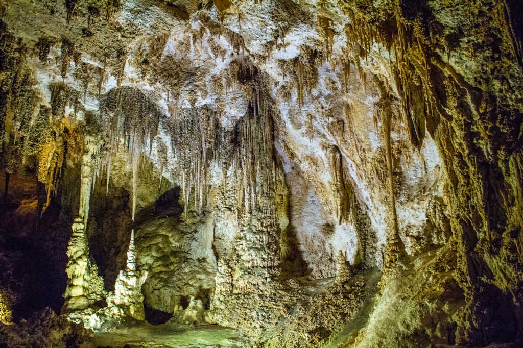
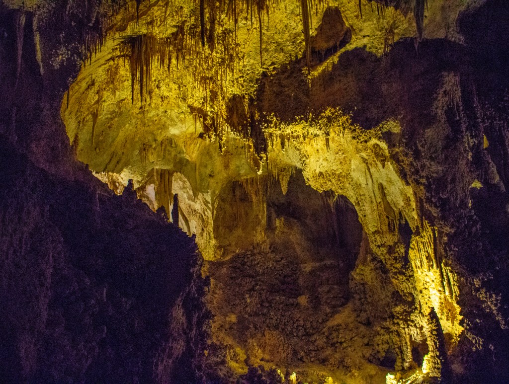
Carlsbad Caverns is by far the most beautiful cave I have ever been in and I have been in a few. Take a look!
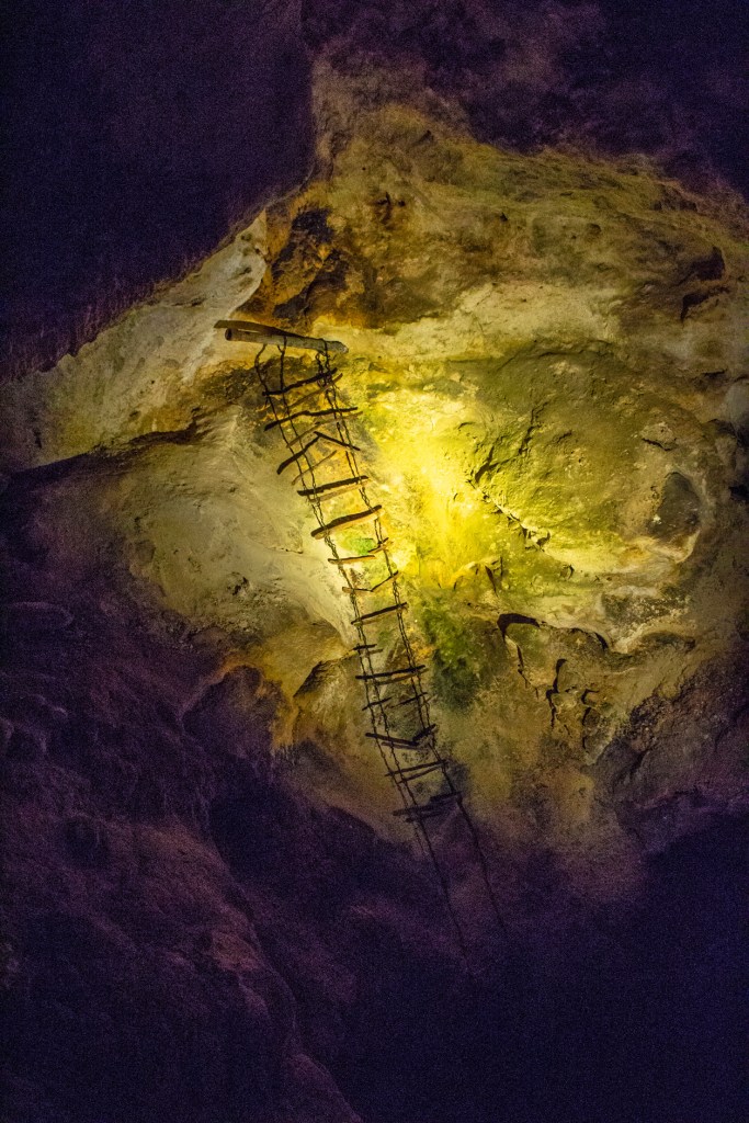
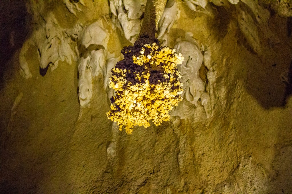
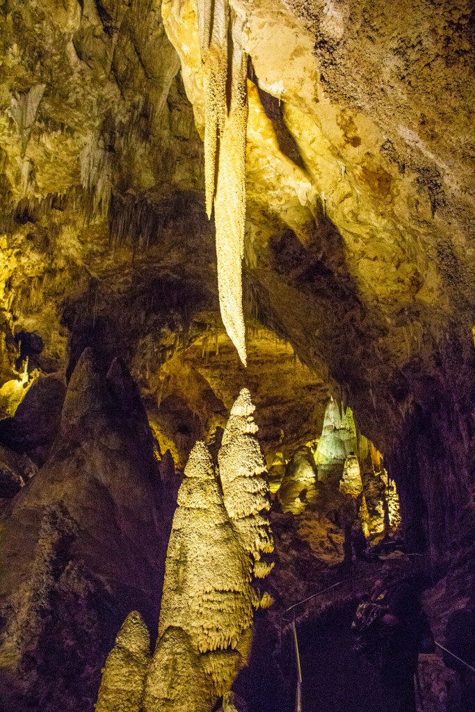
StalactitesStalactites, soda straws and popcorn.ColumnsCave drapery, soda straws and columns.Daggers of death. LOL!Here the bacteria in the water share a symbiotic relationship with the limestone to create the formations surrounding the pond. Flowstone with stalactites and stalagmites. A stalagmite covered in flowstone.A partial view of the Big Room.Stalactites and popcorn.Flowstone on the cave walls.How the early cave explorers got around. Another partial view of the Big Room.The formation in the center of the photo is up to 40 feet in length. How’s that for perspective?Stalagmites.The Lions Tail covered in popcorn.See the Angel?